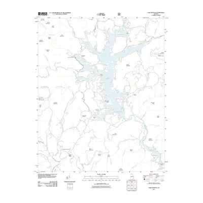
2011 Map of Lake Burton
USGS Topo · Published 2011About this map
Lake Burton and the downstream Seed Lake dominate this mountainous landscape, where the Tallulah River was impounded to create a significant hydroelectric and recreational reservoir system. The intricate shoreline is dotted with local landmarks like Hills Boat Dock and the Georgia State Fish Hatchery, while the surrounding ridges are punctuated by summits such as Glassy Mountain, featuring the Glassy Mountain Lookout.
Find a feature on this map
93 named features on this map. Tap any name to fly to it.
Don’t see what you’re looking for? This feature index may not catch every label — zoom into the map to look around manually.
Map Details
Editions of this 2011 Lake Burton Map
This is the sole edition of this map. No revisions or reprints were ever made.
Other maps of this area

1886 · Dahlonega
USGS Topo · 1:125,000

1886 · Walhalla
USGS Topo · 1:125,000

1892 · Dahlonega
USGS Topo · 1:125,000

1892 · Walhalla
USGS Topo · 1:125,000

1896 · Walhalla
USGS Topo · 1:125,000

1896 · Dahlonega
USGS Topo · 1:125,000

1903 · Dahlonega
USGS Topo · 1:125,000

1935 · Osborn
USGS Topo · 1:24,000

1935 · Dillard
USGS Topo · 1:24,000

1935 · Hightower Bald
USGS Topo · 1:24,000