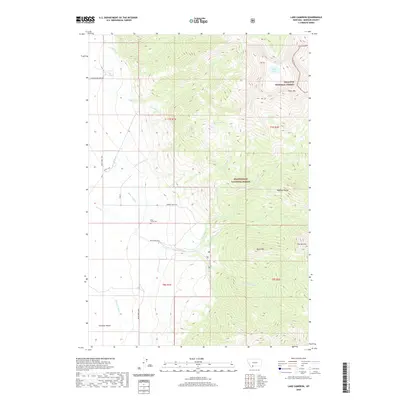
2020 Map of Lake Cameron
USGS Topo · Published 2020About this map
The Madison Range dominates this landscape, where the high alpine terrain of the Gallatin National Forest meets the Beaverhead National Forest. At the center of this mountain environment lies Lake Cameron, surrounded by peaks including Black Mtn and the distinctively named The Helmet. The transition from high peaks to the valley floor is marked by the Cameron Bench, where the engineering of the regional ranching economy becomes visible. A network of man-made waterways, such as the Storey Ditch, Bear Cr Ditch, and Indian Cr Ditch, diverts water from natural streams like Bear Cr to support local agricultural operations. For those researching local heritage, the Bear Creek Cem serves as a small but significant landmark of early settlement near the base of the mountains.
Find a feature on this map
33 named features on this map. Tap any name to fly to it.
Don’t see what you’re looking for? This feature index may not catch every label — zoom into the map to look around manually.
Map Details
Editions of this 2020 Lake Cameron Map
This is the sole edition of this map. No revisions or reprints were ever made.
Other maps of this area

1888 · Three Forks
USGS Topo · 1:250,000

1894 · Three Forks
USGS Topo · 1:250,000

1895 · Three Forks
USGS Topo · 1:250,000

1947 · Bozeman
USGS Topo · 1:250,000

1948 · Bozeman
USGS Topo · 1:250,000

1949 · Ennis
USGS Topo · 1:62,500

1950 · Cameron
USGS Topo · 1:62,500

1950 · Spanish Peaks
USGS Topo · 1:62,500

1950 · Sphinx Mountain
USGS Topo · 1:62,500

1955 · Bozeman
USGS Topo · 1:250,000