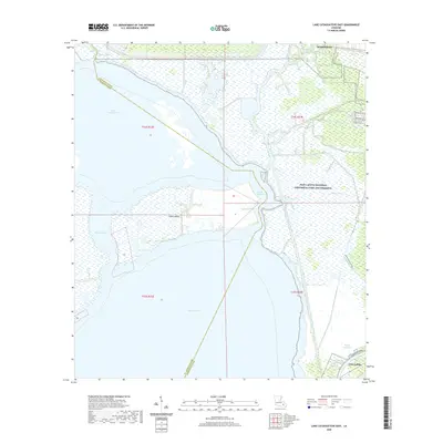
2020 Map of Lake Cataouatche East
USGS Topo · Published 2020About this map
Jean Lafitte National Historical Park and Preserve dominates the eastern delta landscape, where the freshwater marsh of Couba Island separates the expansive Lake Cataouatche from the deeper waters of Lake Salvador. The terrain is a complex network of natural bayous and industrial channels, including the Bayou Segnette Waterway and the Intracoastal Waterway, reflecting the region's historical reliance on waterborne commerce and navigation. In the south, the settlement of Jean Lafitte sits near the junction of Barataria Blvd and Bayou Dauphine, while the southern fringes of Westwego appear at the northern edge. Significant drainage projects like the Millaudon Canal and Woods Place Canal underscore the long-standing efforts to manage water levels across these wetlands at the border of Jefferson and St. Charles Parishes.
Find a feature on this map
29 named features on this map. Tap any name to fly to it.
Don’t see what you’re looking for? This feature index may not catch every label — zoom into the map to look around manually.
Map Details
Editions of this 2020 Lake Cataouatche East Map
This is the sole edition of this map. No revisions or reprints were ever made.
Other maps of this area

1891 · Hahnville
USGS Topo · 1:62,500

1891 · New Orleans
USGS Topo · 1:62,500

1892 · Barataria
USGS Topo · 1:62,500

1892 · Cut-Off
USGS Topo · 1:62,500

1932 · New Orleans NE
USGS Topo · 1:31,680

1932 · New Orleans NW
USGS Topo · 1:31,680

1932 · New Orleans SE
USGS Topo · 1:31,680

1932 · New Orleans SW
USGS Topo · 1:31,680

1932 · Hahnville NE
USGS Topo · 1:31,680

1935 · Luling
USGS Topo · 1:31,680