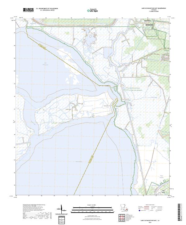
2024 Map of Lake Cataouatche East
USGS Topo · Published 2024About this map
The vast wetland complex between Westwego and Jean Lafitte is a labyrinth of natural bayous and industrial canals. This landscape is defined by the expansive waters of Lake Cataouatche and Lake Salvador, separated by the low-lying Couba Island. The transition from the developed margins of Marrero into the protected reaches of the Jean Lafitte National Historical Park and Preserve illustrates the region's delicate balance between urban expansion and coastal conservation. Human engineering is evident in the straight lines of the Intracoastal Waterway and the Bayou Segnette Waterway, which cut through the marsh to facilitate maritime traffic. Smaller features like the Millaudon Canal and Woods Place Canal speak to historical drainage and land management efforts in Jefferson and St. Charles Parishes, while trails such as the Marsh Overlook Trl allow for modern exploration of these storied wetlands.
Find a feature on this map
32 named features on this map. Tap any name to fly to it.
Don’t see what you’re looking for? This feature index may not catch every label — zoom into the map to look around manually.
Map Details
Editions of this 2024 Lake Cataouatche East Map
This is the sole edition of this map. No revisions or reprints were ever made.
Other maps of this area

1891 · Hahnville
USGS Topo · 1:62,500

1891 · New Orleans
USGS Topo · 1:62,500

1892 · Barataria
USGS Topo · 1:62,500

1892 · Cut-Off
USGS Topo · 1:62,500

1932 · New Orleans NE
USGS Topo · 1:31,680

1932 · New Orleans NW
USGS Topo · 1:31,680

1932 · New Orleans SE
USGS Topo · 1:31,680

1932 · New Orleans SW
USGS Topo · 1:31,680

1932 · Hahnville NE
USGS Topo · 1:31,680

1935 · Luling
USGS Topo · 1:31,680