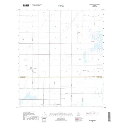
2018 Map of Lake Charles SE
USGS Topo · Published 2018About this map
Holmwood stands as a primary point of reference in this coastal prairie landscape of southern Louisiana, situated just north of the Calcasieu Parish and Cameron Parish line. The terrain is defined by a rigorous grid of section lines and drainage features essential to the region's agricultural character, including Jacques Coulee and the Lidian Bayou Levee Canal. To the west, the Plateau Petit Bois provides a distinct geographical marker amidst a network of rural routes named for local families, such as Rossignol Rd and Le Boeuf Rd. The transition into Cameron Parish to the south reveals a more water-influenced environment, noted by the presence of Rice Field Rd and North Canal, reflecting the land use patterns that have sustained these communities. Bruce Beard Airport serves as a modern landmark within this traditional agricultural corridor during the late 2010s.
Find a feature on this map
44 named features on this map. Tap any name to fly to it.
Don’t see what you’re looking for? This feature index may not catch every label — zoom into the map to look around manually.
Map Details
Editions of this 2018 Lake Charles SE Map
This is the sole edition of this map. No revisions or reprints were ever made.
Other maps of this area

1932 · Lake Charles NE
USGS Topo · 1:31,680

1932 · Lake Charles NW
USGS Topo · 1:31,680

1932 · Lake Charles SW
USGS Topo · 1:31,680

1932 · Lake Charles SE
USGS Topo · 1:31,680

1934 · Lake Misere
USGS Topo · 1:24,000

1934 · Sweet Lake
USGS Topo · 1:24,000

1934 · Boudreaux Lake
USGS Topo · 1:24,000

1935 · Sweet Lake
USGS Topo · 1:31,680

1935 · Lake Misere
USGS Topo · 1:31,680

1935 · Boudreaux Lake
USGS Topo · 1:31,680