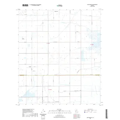
2020 Map of Lake Charles SE
USGS Topo · Published 2020About this map
The low-lying coastal prairie of the Calcasieu Parish Cameron Parish border is defined here by a network of drainage canals and agricultural roads. The settlement of Holmwood sits in the northern section, surrounded by a landscape organized into large rectangular parcels typical of Southwest Louisiana's rice and cattle country. This 2020 survey illustrates the modern configuration of rural infrastructure, where family-named thoroughfares like Rossignol Rd and Fruge Rd intersect with industrial water management features such as the North Canal and Jacques Coulee. The topography is notably flat, punctuated only by the subtle elevation of the Plateau Petit Bois. To the south, aviation interests are represented by the Bruce Beard Airport, while the heavy influence of the regional agricultural economy is visible through specialized routes like Rice Field Rd and Pine Pasture Rd.
Find a feature on this map
43 named features on this map. Tap any name to fly to it.
Don’t see what you’re looking for? This feature index may not catch every label — zoom into the map to look around manually.
Map Details
Editions of this 2020 Lake Charles SE Map
This is the sole edition of this map. No revisions or reprints were ever made.
Other maps of this area

1932 · Lake Charles NE
USGS Topo · 1:31,680

1932 · Lake Charles NW
USGS Topo · 1:31,680

1932 · Lake Charles SW
USGS Topo · 1:31,680

1932 · Lake Charles SE
USGS Topo · 1:31,680

1934 · Lake Misere
USGS Topo · 1:24,000

1934 · Sweet Lake
USGS Topo · 1:24,000

1934 · Boudreaux Lake
USGS Topo · 1:24,000

1935 · Sweet Lake
USGS Topo · 1:31,680

1935 · Lake Misere
USGS Topo · 1:31,680

1935 · Boudreaux Lake
USGS Topo · 1:31,680