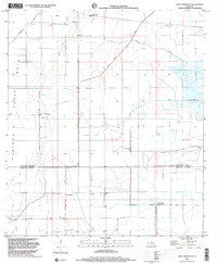
1998 Map of Lake Charles SE
USGS Topo · Published 2001About this map
Holmwood sits at the northern edge of this coastal prairie landscape, where the flat terrain of the Bois Petit Plateau is defined by an extensive network of drainage and irrigation infrastructure. The map illustrates a transition between Calcasieu Parish and Cameron Parish, where the land's management is evidenced by features like the Government Ditch and the North Canal. Local life and spiritual centers are anchored by landmarks such as St Joseph Ch and Sweet Lake Ch, which serve the rural population south of the bayous. The natural hydrology of Indian Bayou and Jacques Coulee is augmented by the Sweet Lake Pumping Station, reflecting the significant human engineering required to manage water in this low-lying region at the close of the twentieth century.
Find a feature on this map
11 named features on this map. Tap any name to fly to it.
Don’t see what you’re looking for? This feature index may not catch every label — zoom into the map to look around manually.
Map Details
Editions of this 1998 Lake Charles SE Map
This is the sole edition of this map. No revisions or reprints were ever made.
Other maps of this area

1932 · Lake Charles NE
USGS Topo · 1:31,680

1932 · Lake Charles NW
USGS Topo · 1:31,680

1932 · Lake Charles SW
USGS Topo · 1:31,680

1932 · Lake Charles SE
USGS Topo · 1:31,680

1934 · Lake Misere
USGS Topo · 1:24,000

1934 · Sweet Lake
USGS Topo · 1:24,000

1934 · Boudreaux Lake
USGS Topo · 1:24,000

1935 · Sweet Lake
USGS Topo · 1:31,680

1935 · Lake Misere
USGS Topo · 1:31,680

1935 · Boudreaux Lake
USGS Topo · 1:31,680