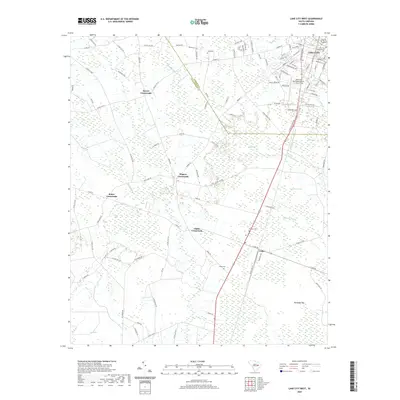
2020 Map of Lake City West
USGS Topo · Published 2020About this map
The town of Lake City anchor the northeastern corner of this landscape, where the urban grid gives way to a sprawling network of wetlands and rural hubs. This area sits on the boundary between Florence County and Williamsburg County, a region defined by its distinctive "bays" and swampy lowlands. Numerous family-named nodes such as Moore Crossroads, Hogeye Crossroads, and Baker Crossroads illustrate a settlement pattern rooted in historic road intersections rather than dense urbanization.
Find a feature on this map
106 named features on this map. Tap any name to fly to it.
Don’t see what you’re looking for? This feature index may not catch every label — zoom into the map to look around manually.
Map Details
Editions of this 2020 Lake City West Map
This is the sole edition of this map. No revisions or reprints were ever made.
Other maps of this area

1946 · Hyman
USGS Topo · 1:62,500

1946 · Kingstree
USGS Topo · 1:62,500

1946 · Lake City
USGS Topo · 1:62,500

1946 · Indiantown
USGS Topo · 1:62,500

1949 · Georgetown
USGS Topo · 1:250,000

1967 · Georgetown
USGS Topo · 1:250,000

1974 · Georgetown
USGS Topo · 1:250,000

1986 · Kingstree
USGS Topo · 1:100,000
1990 · Hebron Crossroads
USGS Topo · 1:24,000
1990 · Olanta
USGS Topo · 1:24,000