
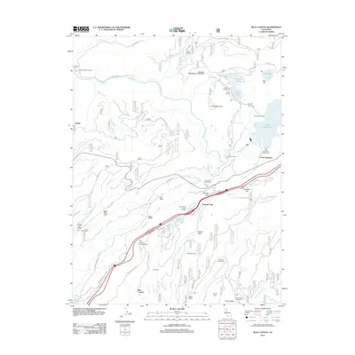
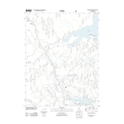
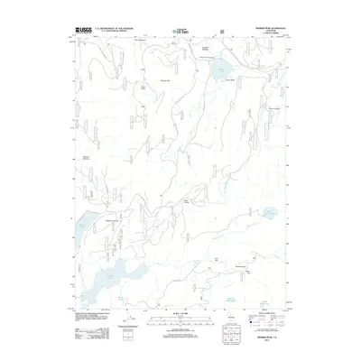
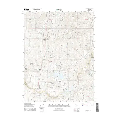
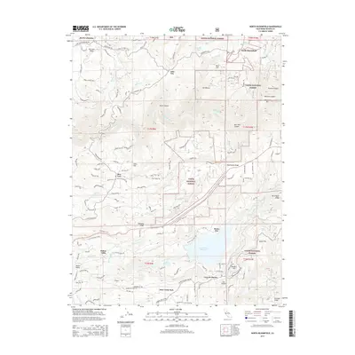
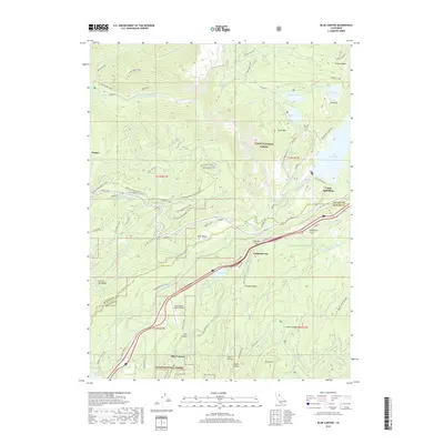
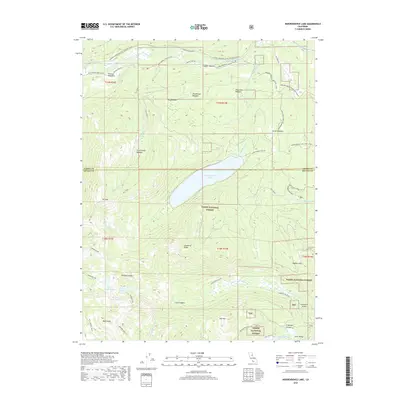
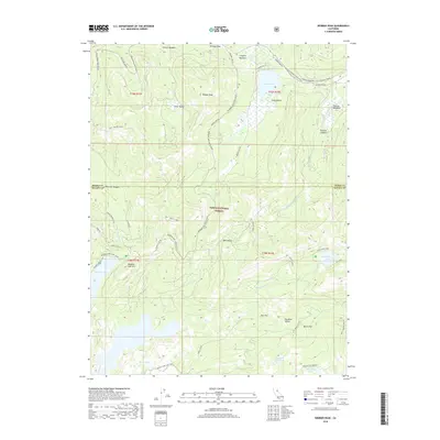
1995 Map of Lake Combie
USGS Topo · Published 1995About this map
Lake Combie and the Lake of the Pines dominate this landscape on the border of Nevada and Placer counties, illustrating the mid-90s residential and recreational character of the Sierra Nevada foothills. The map captures a transition from rural mining roots to educational and suburban expansion, evidenced by the concentration of campuses like Bear River High School and Magnolia Junior High School. Water management is central to the area's development, with the Combie Aqueduct, Tarr Ditch, and Maben Ditch tracing the contours of the land, serving a legacy of hydraulic needs.
Find a feature on this map
50 named features on this map. Tap any name to fly to it.
Don’t see what you’re looking for? This feature index may not catch every label — zoom into the map to look around manually.
Map Details
Editions of this 1995 Lake Combie Map
This is the sole edition of this map. No revisions or reprints were ever made.
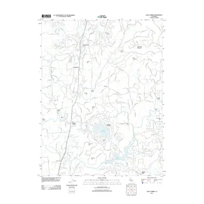
Historical Maps of Higgins Corner Through Time
82 maps found

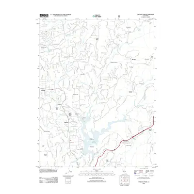
1949 Chicago Park
Nevada County, CA

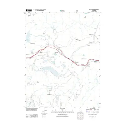
1949 Lake Combie
Nevada County, CA

1949 North Bloomfield
Nevada County, CA

1949 Rough And Ready
Nevada County, CA

1949 Wolf
Nevada County, CA

1950 Lake Combie
Nevada County, CA

1950 Rough And Ready
Nevada County, CA

1950 Wolf
Nevada County, CA

1951 Chicago Park
Nevada County, CA

1951 North Bloomfield
Nevada County, CA

1955 Blue Canyon
Nevada County, CA

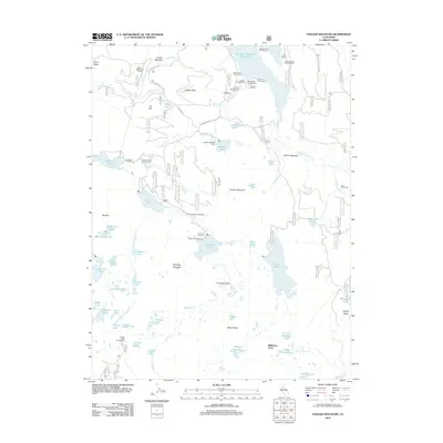
1955 Boca
Nevada County, CA

1955 Cisco Grove
Nevada County, CA

1955 Donner Pass
Nevada County, CA

1955 Emigrant Gap
Nevada County, CA

1981 Hobart Mills
Nevada County, CA

1981 Independence Lake
Nevada County, CA

1981 Webber Peak
Nevada County, CA

1983 English Mtn
Nevada County, CA
1995 Lake Combie
Nevada County, CA

1995 Rough And Ready
Nevada County, CA

1995 Wolf
Nevada County, CA

1998 Lake Combie
Nevada County, CA

1998 Rough And Ready
Nevada County, CA

1998 Wolf
Nevada County, CA

2000 Blue Canyon
Nevada County, CA

2000 Boca
Nevada County, CA

2000 Chicago Park
Nevada County, CA

2000 Cisco Grove
Nevada County, CA

2000 English Mountain
Nevada County, CA

2000 Hobart Mills
Nevada County, CA

2000 Independence Lake
Nevada County, CA

2000 North Bloomfield
Nevada County, CA

2000 Webber Peak
Nevada County, CA
2012 Blue Canyon
Nevada County, CA

2012 Boca
Nevada County, CA
2012 Chicago Park
Nevada County, CA
2012 Cisco Grove
Nevada County, CA
2012 English Mountain
Nevada County, CA
2012 Hobart Mills
Nevada County, CA

2012 Independence Lake
Nevada County, CA
2012 Lake Combie
Nevada County, CA
2012 North Bloomfield
Nevada County, CA
2012 Rough And Ready
Nevada County, CA
2012 Webber Peak
Nevada County, CA
2012 Wolf
Nevada County, CA

2015 Blue Canyon
Nevada County, CA

2015 Boca
Nevada County, CA
2015 Chicago Park
Nevada County, CA
2015 Cisco Grove
Nevada County, CA
2015 English Mountain
Nevada County, CA
2015 Hobart Mills
Nevada County, CA
2015 Independence Lake
Nevada County, CA
2015 Lake Combie
Nevada County, CA
2015 North Bloomfield
Nevada County, CA
2015 Rough And Ready
Nevada County, CA
2015 Webber Peak
Nevada County, CA
2015 Wolf
Nevada County, CA
2018 Blue Canyon
Nevada County, CA
2018 Boca
Nevada County, CA

2018 Chicago Park
Nevada County, CA

2018 Cisco Grove
Nevada County, CA
2018 English Mountain
Nevada County, CA
2018 Hobart Mills
Nevada County, CA
2018 Independence Lake
Nevada County, CA
2018 Lake Combie
Nevada County, CA
2018 North Bloomfield
Nevada County, CA
2018 Rough And Ready
Nevada County, CA
2018 Webber Peak
Nevada County, CA
2018 Wolf
Nevada County, CA

2021 Hobart Mills
Nevada County, CA

2021 Independence Lake
Nevada County, CA

2021 Lake Combie
Nevada County, CA

2021 Rough And Ready
Nevada County, CA

2021 Webber Peak
Nevada County, CA

2022 Blue Canyon
Nevada County, CA

2022 Boca
Nevada County, CA

2022 Chicago Park
Nevada County, CA

2022 Cisco Grove
Nevada County, CA

2022 English Mountain
Nevada County, CA

2022 North Bloomfield
Nevada County, CA

2022 Wolf
Nevada County, CA
Featured Locations
- Cherry Creek Acres, CA
- Alta Sierra Estates, CA
- Higgins Corner, CA
- Willaura Estates, CA
- Sierra Knoll Estates, CA