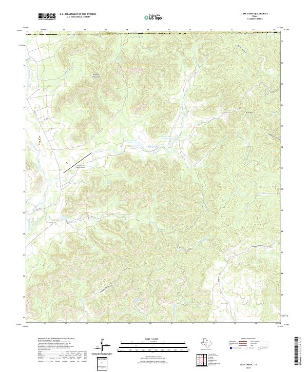
2022 Map of Lake Creek
USGS Topo · Published 2022About this map
The Nueces River winds along the western edge of this landscape, defining a sharp border between the river valley and the limestone uplands of the Rawhide Mountains. This portion of the Balcones Escarpment is characterized by a dense network of drainages and springs, including Rawhide Spring, Spring Creek Spring, and Walnut Springs, which feed into major tributaries like Lake Cr and Blucher Creek. The terrain is marked by significant topographical relief, with isolated peaks such as Mule Mtn and deep cuts like Dugwell Canyon and Fulghum Hollow.
Find a feature on this map
31 named features on this map. Tap any name to fly to it.
Don’t see what you’re looking for? This feature index may not catch every label — zoom into the map to look around manually.
Map Details
Editions of this 2022 Lake Creek Map
This is the sole edition of this map. No revisions or reprints were ever made.
Other maps of this area

1893 · Nueces
USGS Topo · 1:125,000

1896 · Nueces
USGS Topo · 1:125,000

1896 · Brackett
USGS Topo · 1:125,000

1897 · Brackett
USGS Topo · 1:125,000

1898 · Uvalde
USGS Topo · 1:125,000

1899 · Uvalde
USGS Topo · 1:125,000

1938 · Turkey Mountain
USGS Topo · 1:48,000

1943 · Turkey Mountain
USGS Topo · 1:62,500

1944 · Barksdale
USGS Topo · 1:62,500

1954 · San Antonio
USGS Topo · 1:250,000