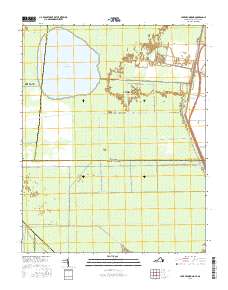
2016 Map of Lake Drummond
USGS Topo · Published 2016About this map
Great Dismal Swamp dominates this landscape along the border of Virginia and North Carolina, where the large, circular basin of Lake Drummond serves as a central hydrologic landmark. This 2016 survey illustrates the extensive network of historic and modern drainage features that define the region's management, including Feeder Ditch, Cross Canal, and the Dismal Swamp Canal. The settlement of Wallaceton appears on the northeastern edge, situated along the canal and the parallel Intracoastal Waterway. This area is characterized by its unique transition from the Suffolk and Chesapeake municipal boundaries down into Camden, Gates, and Pasquotank counties. The map preserves numerous family and local names attached to the landscape's water management system, such as Kim Saunders Ditch, Riddick Ditch, and Bull Boulevard Ditch, providing a detailed record of the swamp's artificial and natural hydrology.
Find a feature on this map
34 named features on this map. Tap any name to fly to it.
Don’t see what you’re looking for? This feature index may not catch every label — zoom into the map to look around manually.
Map Details
Editions of this 2016 Lake Drummond Map
This is the sole edition of this map. No revisions or reprints were ever made.
Other maps of this area

1906 · Beckford
USGS Topo · 1:48,000

1907 · Beckford
USGS Topo · 1:62,500

1919 · Suffolk
USGS Topo · 1:62,500

1940 · Beckford
USGS Topo · 1:62,500

1940 · Lake Drummond
USGS Topo · 1:62,500

1940 · South Mills
USGS Topo · 1:62,500

1945 · Lake Drummond
USGS Topo · 1:62,500

1952 · South Mills
USGS Topo · 1:62,500

1953 · Norfolk
USGS Topo · 1:250,000

1954 · Corapeake
USGS Topo · 1:24,000