
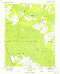
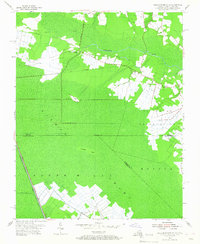
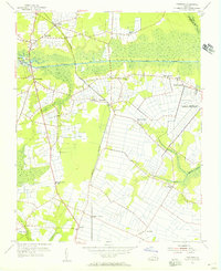
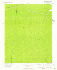
1954 Map of Lake Drummond SE
USGS Topo · Published 1972About this map
The Dismal Swamp dominates this landscape, straddling the border between Virginia and North Carolina where Chesapeake City meets the state line. This mid-century survey reveals a delicate balance between the persistent wetlands and early efforts at drainage and transport. The Northwest River snakes through the northern territory, while the Intracoastal Waterway and the Lake Drummond Causeway provide critical transit corridors through the marsh. Higher ground is represented by Smith Ridge and the isolated Culpeper Island, providing small pockets of firm terrain in an otherwise saturated environment.
Find a feature on this map
17 named features on this map. Tap any name to fly to it.
Don’t see what you’re looking for? This feature index may not catch every label — zoom into the map to look around manually.
Map Details
Editions of this 1954 Lake Drummond SE Map
Other maps of this area

1939 · Moyock
USGS Topo · 1:62,500

1940 · Lake Drummond
USGS Topo · 1:62,500

1940 · South Mills
USGS Topo · 1:62,500

1945 · Lake Drummond
USGS Topo · 1:62,500

1946 · Moyock
USGS Topo · 1:62,500

1948 · Elizabeth City
USGS Topo · 1:62,500

1952 · South Mills
USGS Topo · 1:62,500

1953 · Norfolk
USGS Topo · 1:250,000
1954 · Fentress
USGS Topo · 1:24,000
1954 · Lake Drummond NW
USGS Topo · 1:24,000