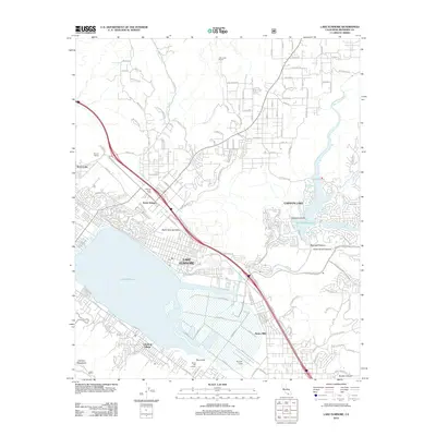
2012 Map of Lake Elsinore
USGS Topo · Published 2012About this map
The massive basin of Lake Elsinore dominates the southern landscape of this Riverside County quadrangle, showing the expansive shoreline adjacent to Lakeland Village. In the northeast, the San Jacinto River feeds into Canyon Lake, also identified as the Railroad Reservoir, where the water is fragmented into numerous bays such as Mariners Bay and Holiday Bay around Skippers Island.
Find a feature on this map
143 named features on this map. Tap any name to fly to it.
Don’t see what you’re looking for? This feature index may not catch every label — zoom into the map to look around manually.
Map Details
Editions of this 2012 Lake Elsinore Map
This is the sole edition of this map. No revisions or reprints were ever made.
Other maps of this area

1901 · Southern California Sheet No. 1
USGS Topo · 1:250,000

1901 · Elsinore
USGS Topo · 1:125,000

1901 · Riverside
USGS Topo · 1:62,500

1904 · Southern California Sheet No. 1
USGS Topo · 1:250,000

1942 · Lake Elsinore
USGS Topo · 1:62,500

1942 · Murrieta
USGS Topo · 1:62,500

1942 · Riverside
USGS Topo · 1:62,500

1942 · Perris
USGS Topo · 1:62,500

1943 · Perris
USGS Topo · 1:62,500

1943 · Riverside
USGS Topo · 1:62,500