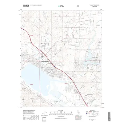
2018 Map of Lake Elsinore
USGS Topo · Published 2018About this map
Lake Elsinore and the winding course of the San Jacinto River anchor this modern survey of Riverside County's expanding suburbs and recreation hubs. To the east, the artificial Railroad Reservoir creates a complex shoreline for the residential community of Canyon Lake, featuring numerous finger-like projections such as Mariners Bay, East Bay, and Holiday Bay. The map captures the transition from the steep eastern slopes of the Elsinore Mountains within the Cleveland National Forest to the developed valleys of North Elsinore and Lakeland Village.
Find a feature on this map
267 named features on this map. Tap any name to fly to it.
Don’t see what you’re looking for? This feature index may not catch every label — zoom into the map to look around manually.
Map Details
Editions of this 2018 Lake Elsinore Map
This is the sole edition of this map. No revisions or reprints were ever made.
Other maps of this area

1901 · Southern California Sheet No. 1
USGS Topo · 1:250,000

1901 · Elsinore
USGS Topo · 1:125,000

1901 · Riverside
USGS Topo · 1:62,500

1904 · Southern California Sheet No. 1
USGS Topo · 1:250,000

1942 · Lake Elsinore
USGS Topo · 1:62,500

1942 · Murrieta
USGS Topo · 1:62,500

1942 · Riverside
USGS Topo · 1:62,500

1942 · Perris
USGS Topo · 1:62,500

1943 · Perris
USGS Topo · 1:62,500

1943 · Riverside
USGS Topo · 1:62,500