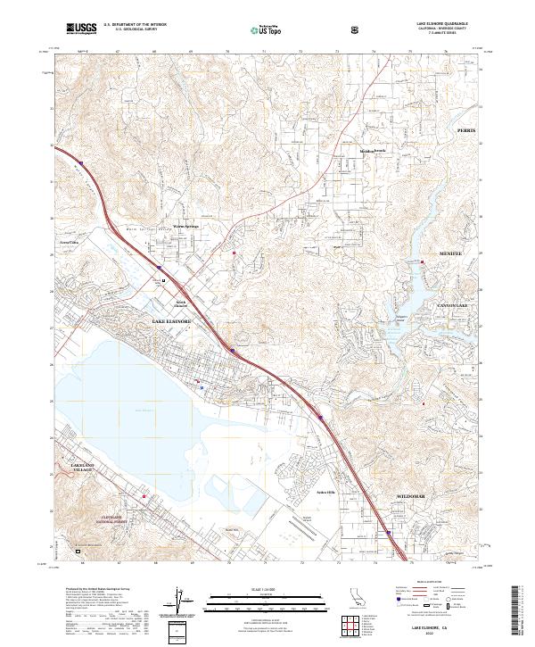
2022 Map of Lake Elsinore
USGS Topo · Published 2022About this map
Lake Elsinore and its surrounding communities are captured here in a period of significant suburban expansion, where the natural basin of the San Jacinto River meets the rising slopes of the Elsinore Mountains. The map reveals a complex water management system centered on the Railroad Reservoir, featuring numerous inlets such as Mariners Bay and Holiday Bay. These recreational and residential developments contrast with the preserved wilderness of the Cleveland National Forest to the southwest.
Find a feature on this map
269 named features on this map. Tap any name to fly to it.
Don’t see what you’re looking for? This feature index may not catch every label — zoom into the map to look around manually.
Map Details
Editions of this 2022 Lake Elsinore Map
This is the sole edition of this map. No revisions or reprints were ever made.
Other maps of this area

1901 · Southern California Sheet No. 1
USGS Topo · 1:250,000

1901 · Elsinore
USGS Topo · 1:125,000

1901 · Riverside
USGS Topo · 1:62,500

1904 · Southern California Sheet No. 1
USGS Topo · 1:250,000

1942 · Lake Elsinore
USGS Topo · 1:62,500

1942 · Murrieta
USGS Topo · 1:62,500

1942 · Riverside
USGS Topo · 1:62,500

1942 · Perris
USGS Topo · 1:62,500

1943 · Perris
USGS Topo · 1:62,500

1943 · Riverside
USGS Topo · 1:62,500