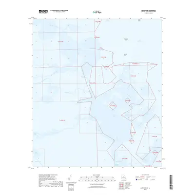
2018 Map of Lake Eugenie
USGS Topo · Published 2018About this map
Lake Eugenie and the intricate wetlands of Saint Bernard Parish dominate this coastal survey, where the terrestrial landscape dissolves into a complex network of bayous and brackish basins. The map illustrates a shifting environment defined by the ebb and flow of Gulf waters through arteries like Bayou Biloxi and Bayou la Loutre. Geographic landmarks such as Wild Goose Island and Cat Fish Point provide the only significant relief in a region where water and land are nearly indistinguishable. Notable coastal features like Pirate Point and False Mouth Bay highlight the tidal complexity of the Mississippi River Delta's eastern edge. The presence of Lake of the Mound suggests long-term human interaction with this marshy terrain, providing a point of interest for those studying the intersection of coastal geography and regional history.
Find a feature on this map
27 named features on this map. Tap any name to fly to it.
Don’t see what you’re looking for? This feature index may not catch every label — zoom into the map to look around manually.
Map Details
Editions of this 2018 Lake Eugenie Map
This is the sole edition of this map. No revisions or reprints were ever made.
Other maps of this area

1893 · Rigolets
USGS Topo · 1:62,500

1893 · Shell Beach
USGS Topo · 1:62,500

1893 · Toulme
USGS Topo · 1:62,500

1895 · Bodreau
USGS Topo · 1:62,500

1935 · Morgan Harbor
USGS Topo · 1:31,680

1936 · Rigolets
USGS Topo · 1:62,500

1939 · Shell Beach
USGS Topo · 1:62,500

1941 · Shell Beach
USGS Topo · 1:62,500

1946 · Oak Mound Bayou
USGS Topo · 1:31,680

1946 · Lake Eugenie
USGS Topo · 1:31,680