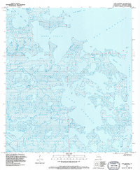
1994 Map of Lake Eugenie
USGS Topo · Published 1995About this map
The fragmented marshlands of coastal St. Bernard Parish are defined by an intricate network of waterways where Lake Eugenie meets the open waters of Bay Boudreau. This 1994 map illustrates a landscape dominated by tidal action and sediment, where large shallow bodies of water like Bobs Lakes and False Mouth Bay are separated only by thin strips of marsh. Navigational arteries such as Bayou Biloxi, Bayou Marron, and Bayou Domingo wind through the interior, providing the only transit routes through the saturated terrain. Further south, the map identifies Lake of the Mound and Bayou Loutre, hinting at the traditional geography of the Mississippi River delta plain. The absence of roads or structures underscores the area's isolation, where the economy and local history are tied entirely to the bayous and lagoons of the outer marsh.
Find a feature on this map
19 named features on this map. Tap any name to fly to it.
Don’t see what you’re looking for? This feature index may not catch every label — zoom into the map to look around manually.
Map Details
Editions of this 1994 Lake Eugenie Map
This is the sole edition of this map. No revisions or reprints were ever made.
Other maps of this area

1893 · Rigolets
USGS Topo · 1:62,500

1893 · Shell Beach
USGS Topo · 1:62,500

1893 · Toulme
USGS Topo · 1:62,500

1895 · Bodreau
USGS Topo · 1:62,500

1935 · Morgan Harbor
USGS Topo · 1:31,680

1936 · Rigolets
USGS Topo · 1:62,500

1939 · Shell Beach
USGS Topo · 1:62,500

1941 · Shell Beach
USGS Topo · 1:62,500

1946 · Oak Mound Bayou
USGS Topo · 1:31,680

1946 · Lake Eugenie
USGS Topo · 1:31,680