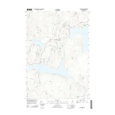
2015 Map of Lake Francis
USGS Topo · Published 2015About this map
Lake Francis dominates the lower half of this northern New Hampshire landscape, where the Connecticut River flows through a series of significant water bodies and mountain ridges. The settlement of Happy Corner serves as a local landmark near the Happy Corner Bridge, while The Glen sits at the northern edge of First Connecticut Lake. The terrain is defined by prominent peaks including Prospect Mtn, South Mtn, and Bear Mtn, with smaller water features like Back Lake and Jacquith Pond scattered throughout the drainage basins. A network of local roads such as Moose Pond Rd and Back Lake Rd provides access to the shoreline and higher elevations. This modern survey captures the region's managed hydrography and recreation-focused geography, illustrating how the river system and its various ponded reaches structure the northern Coos County environment.
Find a feature on this map
92 named features on this map. Tap any name to fly to it.
Don’t see what you’re looking for? This feature index may not catch every label — zoom into the map to look around manually.
Map Details
Editions of this 2015 Lake Francis Map
This is the sole edition of this map. No revisions or reprints were ever made.
Other maps of this area

1925 · Indian Stream
USGS Topo · 1:48,000

1926 · Indian Stream
USGS Topo · 1:62,500

1927 · Indian Stream
USGS Topo · 1:62,500

1927 · Second Lake
USGS Topo · 1:62,500

1930 · Dixville
USGS Topo · 1:62,500

1930 · Errol
USGS Topo · 1:62,500

1932 · Second Lake
USGS Topo · 1:62,500

1933 · Dixville
USGS Topo · 1:62,500

1934 · Dixville
USGS Topo · 1:62,500

1934 · Errol
USGS Topo · 1:62,500