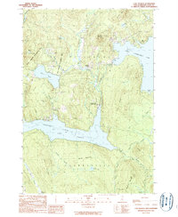
1989 Map of Lake Francis
USGS Topo · Published 1989About this map
Lake Francis dominates this North Country landscape, its waters contained by an Earth Dam and flanked by Lake Francis State Park. This late-1980s survey captures the area as a destination for outdoor recreation and wildlife conservation, evidenced by the large State Wildlife Management Area and various Snowmobile Trails crisscrossing the timbered highlands. Small settlements like Happy Corner and The Glen mark the human presence along the winding Connecticut River corridor. Historical infrastructure remains visible through the notation of a Covered Bridge and a local Cem near the township line between Pittsburg and Clarksville. The geography is defined by significant water bodies, including Back Lake and the southern reach of the First Connecticut Lake, set against a backdrop of prominent peaks like Prospect Mountain and Covell Mtn.
Find a feature on this map
43 named features on this map. Tap any name to fly to it.
Don’t see what you’re looking for? This feature index may not catch every label — zoom into the map to look around manually.
Map Details
Editions of this 1989 Lake Francis Map
This is the sole edition of this map. No revisions or reprints were ever made.
Other maps of this area

1925 · Indian Stream
USGS Topo · 1:48,000

1926 · Indian Stream
USGS Topo · 1:62,500

1927 · Indian Stream
USGS Topo · 1:62,500

1927 · Second Lake
USGS Topo · 1:62,500

1930 · Dixville
USGS Topo · 1:62,500

1930 · Errol
USGS Topo · 1:62,500

1932 · Second Lake
USGS Topo · 1:62,500

1933 · Dixville
USGS Topo · 1:62,500

1934 · Dixville
USGS Topo · 1:62,500

1934 · Errol
USGS Topo · 1:62,500