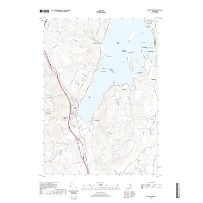
2019 Map of Lake George
USGS Topo · Published 2019About this map
Lake George dominates this landscape, serving as the focal point for a complex network of bays, islands, and lakeside settlements. The village of Lake George occupies the southern shore, featuring a detailed street grid with names like Mohican St and Ottawa St, while the community of Crosbyside sits across the water to the east. The map highlights the area's transition from the dense village center to the steep, wooded slopes of Prospect Mtn and French Mtn.
Find a feature on this map
116 named features on this map. Tap any name to fly to it.
Don’t see what you’re looking for? This feature index may not catch every label — zoom into the map to look around manually.
Map Details
Editions of this 2019 Lake George Map
This is the sole edition of this map. No revisions or reprints were ever made.
Other maps of this area

1895 · North Creek
USGS Topo · 1:62,500

1895 · Glens Falls
USGS Topo · 1:62,500

1897 · Bolton
USGS Topo · 1:62,500

1897 · Glens Falls
USGS Topo · 1:62,500

1897 · North Creek
USGS Topo · 1:62,500

1900 · Bolton
USGS Topo · 1:62,500

1903 · Luzerne
USGS Topo · 1:62,500

1938 · Glens Falls
USGS Topo · 1:62,500

1947 · Glens Falls
USGS Topo · 1:62,500

1950 · Glens Falls
USGS Topo · 1:250,000