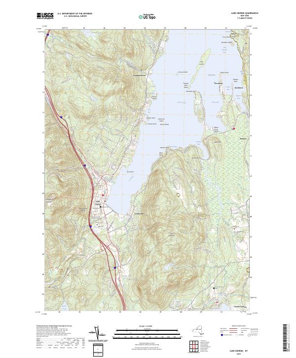
2023 Map of Lake George
USGS Topo · Published 2023About this map
Lake George dominates the landscape as it stretches northward between the elevations of Prospect Mountain and French Mountain. This modern survey reveals a complex shoreline of bays and points that have long defined the region's character, from the residential clusters at Diamond Point and Crosbyside to the narrow finger of Assembly Point reaching into the water. The map provides significant detail for genealogists, particularly through the locations of established burial grounds such as Caldwell Cem and Evergreen Cem near the village, and the Scotch Church Cem further south towards Oneida Corners. These sites, along with landmarks like Rattlesnake Cobble and the scattered islands including Diamond Island and the Happy Family Islands, illustrate the intersection of a deep-rooted Adirondack community with its distinct glacial topography.
Find a feature on this map
130 named features on this map. Tap any name to fly to it.
Don’t see what you’re looking for? This feature index may not catch every label — zoom into the map to look around manually.
Map Details
Editions of this 2023 Lake George Map
This is the sole edition of this map. No revisions or reprints were ever made.
Other maps of this area

1895 · North Creek
USGS Topo · 1:62,500

1895 · Glens Falls
USGS Topo · 1:62,500

1897 · Bolton
USGS Topo · 1:62,500

1897 · Glens Falls
USGS Topo · 1:62,500

1897 · North Creek
USGS Topo · 1:62,500

1900 · Bolton
USGS Topo · 1:62,500

1903 · Luzerne
USGS Topo · 1:62,500

1938 · Glens Falls
USGS Topo · 1:62,500

1947 · Glens Falls
USGS Topo · 1:62,500

1950 · Glens Falls
USGS Topo · 1:250,000