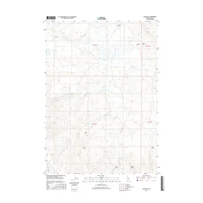
2017 Map of Lake Hills
USGS Topo · Published 2017About this map
Lake Hills and the surrounding high desert of Blaine County are defined by a sophisticated network of water management and distinct topographic landmarks. The landscape is dotted with critical water sources for the region, including Campbell Reservoir, Cameron Reservoir, and Howard Reservoir. These man-made features are complemented by natural flows such as S Fork Muldoon Cr and Little Fish Cr. The presence of several named springs, such as Billingsley Spring and Watercress Spring, highlights the essential hydrology of this arid environment. Significant elevation markers like Flat Top and Black Nose rise above the drainage basins, providing orientation in a territory marked by deep incisions like Box Canyon and Road Canyon. In the southwest corner, the Little Wood River and the W Canal represent the infrastructure required to support agricultural or ranching activities in the valleys below the hills.
Find a feature on this map
27 named features on this map. Tap any name to fly to it.
Don’t see what you’re looking for? This feature index may not catch every label — zoom into the map to look around manually.
Map Details
Editions of this 2017 Lake Hills Map
This is the sole edition of this map. No revisions or reprints were ever made.
Other maps of this area

1895 · Hailey
USGS Topo · 1:125,000

1897 · Hailey
USGS Topo · 1:125,000

1935 · MacKay
USGS Topo · 1:96,000

1955 · Idaho Falls
USGS Topo · 1:250,000

1955 · Hailey
USGS Topo · 1:250,000

1958 · Idaho Falls
USGS Topo · 1:250,000

1959 · Hailey
USGS Topo · 1:250,000

1960 · Muldoon Canyon
USGS Topo · 1:62,500

1962 · Hailey
USGS Topo · 1:250,000

1967 · Baugh Creek
USGS Topo · 1:24,000