
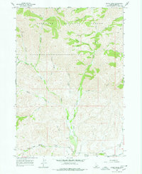
1967 Map of Baugh Creek
USGS Topo · Published 1971About this map
The Sawtooth National Forest dominates this Idaho landscape, characterized by a complex network of drainage basins and high-elevation terrain. The Little Wood River flows through the central corridor, joined by tributaries like Baugh Creek and Muldoon Creek. Human activity in the late 1960s is represented by primitive transportation routes, including a Pack Trail and several Jeep Trails that navigate the ridges between Hailey Creek and Chicken Creek. A solitary Mine located near the headwaters of Kate Creek points to the area's prospecting history. The map also records numerous seasonal and perennial water sources, such as Cold Spring Creek and Sheep Creek, which were vital for the region's wilderness management and potential grazing activities.
Find a feature on this map
27 named features on this map. Tap any name to fly to it.
Don’t see what you’re looking for? This feature index may not catch every label — zoom into the map to look around manually.
Map Details
Editions of this 1967 Baugh Creek Map
2 editions found
Other maps of this area

1895 · Hailey
USGS Topo · 1:125,000

1897 · Hailey
USGS Topo · 1:125,000

1935 · MacKay
USGS Topo · 1:96,000

1955 · Idaho Falls
USGS Topo · 1:250,000

1955 · Hailey
USGS Topo · 1:250,000

1958 · Idaho Falls
USGS Topo · 1:250,000

1959 · Hailey
USGS Topo · 1:250,000

1960 · Muldoon Canyon
USGS Topo · 1:62,500

1962 · Hailey
USGS Topo · 1:250,000

1967 · Baugh Creek SW
USGS Topo · 1:24,000