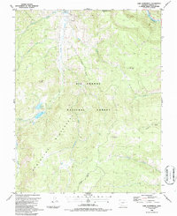
1986 Map of Lake Humphreys
USGS Topo · Published 1986About this map
Weminuche Wilderness and the Rio Grande National Forest dominate this high-altitude landscape in Mineral County, surveyed in the early 1980s. The terrain is defined by a network of drainage systems feeding into the Rio Grande, including Goose Creek, Soda Creek, and Trout Creek. These waters flow beneath prominent summits such as Turret Peak, Elk Mountain, and Mc Clelland Mountain. Evidence of early exploration and resource extraction appears in the north, where a Mine and several Prospects are marked near a Hot Spring and a Well.
Find a feature on this map
26 named features on this map. Tap any name to fly to it.
Don’t see what you’re looking for? This feature index may not catch every label — zoom into the map to look around manually.
Map Details
Editions of this 1986 Lake Humphreys Map
2 editions found
Other maps of this area

1914 · Creede
USGS Topo · 1:125,000

1916 · Creede
USGS Topo · 1:125,000

1945 · Durango
USGS Topo · 1:250,000

1953 · Durango
USGS Topo · 1:250,000

1954 · Durango
USGS Topo · 1:250,000

1957 · Spar City
USGS Topo · 1:62,500

1959 · Creede
USGS Topo · 1:62,500

1961 · Durango
USGS Topo · 1:250,000

1963 · Durango
USGS Topo · 1:250,000

1966 · Durango
USGS Topo · 1:250,000