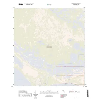
2024 Map of Lake Ingraham East
USGS Topo · Published 2024About this map
The Marjory Stoneman Douglas Wilderness preserves a vast aquatic and wetland landscape at the southwestern tip of Florida. This remote coastal environment is defined by the meeting of the Gulf of Mexico and Florida Bay, with Cape Sable forming a prominent shoreline feature. Internal waterways such as the Joe River and Whitewater Bay dominate the northern portion of the map, while the interior is a complex of shallow lakes including Gator Lake, Cattail Lakes, and several named after the fox.
Find a feature on this map
21 named features on this map. Tap any name to fly to it.
Don’t see what you’re looking for? This feature index may not catch every label — zoom into the map to look around manually.
Map Details
Editions of this 2024 Lake Ingraham East Map
This is the sole edition of this map. No revisions or reprints were ever made.
Other maps of this area

1956 · Miami
USGS Topo · 1:250,000

1958 · Miami
USGS Topo · 1:250,000

1972 · Whitewater Bay West
USGS Topo · 1:24,000

1972 · Whitewater Bay East
USGS Topo · 1:24,000

1972 · Lake Ingraham East
USGS Topo · 1:24,000
1972 · Lake Ingraham West
USGS Topo · 1:24,000

1972 · Sandy Key
USGS Topo · 1:24,000

1972 · Clive Key
USGS Topo · 1:24,000

1972 · Shark River Island
USGS Topo · 1:24,000
1973 · Flamingo
USGS Topo · 1:24,000