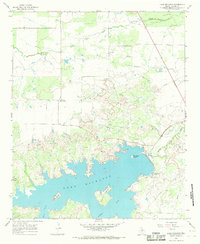
1966 Map of Lake Kickapoo
USGS Topo · Published 1968About this map
Lake Kickapoo and the surrounding ranchlands of Archer County define this mid-1960s landscape, where the North Fork Little Wichita River is harnessed for regional water storage. The reservoir's intricate shoreline is dotted with named landforms such as Long Island, Council Island, and the distinctively named Pancake Island. North of the lake, the terrain transitions into a productive extraction landscape marked by numerous oil wells and several gravel pits, indicating the sub-surface wealth of the North Texas plains.
Find a feature on this map
18 named features on this map. Tap any name to fly to it.
Don’t see what you’re looking for? This feature index may not catch every label — zoom into the map to look around manually.
Map Details
Editions of this 1966 Lake Kickapoo Map
This is the sole edition of this map. No revisions or reprints were ever made.
Other maps of this area

1931 · Archer City
USGS Topo · 1:62,500

1932 · Dundee
USGS Topo · 1:62,500

1954 · Wichita Falls
USGS Topo · 1:250,000

1957 · Wichita Falls West
USGS Topo · 1:62,500

1958 · Wichita Falls
USGS Topo · 1:250,000

1963 · Dundee
USGS Topo · 1:24,000

1963 · Dundee SW
USGS Topo · 1:24,000

1964 · Dundee SE
USGS Topo · 1:24,000

1964 · Archer City West
USGS Topo · 1:24,000
1966 · Mankins
USGS Topo · 1:24,000