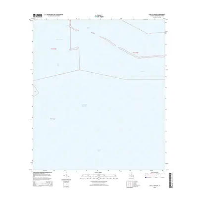
2015 Map of Lake La Graisse
USGS Topo · Published 2015About this map
Lake La Graisse and the surrounding marshlands of Terrebonne Parish are depicted here as they appeared in 2015. This coastal landscape is defined by the complex transition between interior bayous and the open waters of the Gulf of Mexico. Significant hydrological features include Seabreeze Pass and Bayou Jose, which facilitate the movement of water through the fragile wetland system. To the south, Terrebonne Bay dominates the lower half of the quadrangle, with the prominent landmark of Point Meshe extending into the water. This digital-era survey illustrates the delicate balance of the Louisiana coastline, documenting the proximity of Bay Lost Reef and Pass Barre to the fluctuating shoreline. The map provides a precise record of these landforms for environmental researchers and those tracking coastal change in the early 21st century.
Find a feature on this map
10 named features on this map. Tap any name to fly to it.
Don’t see what you’re looking for? This feature index may not catch every label — zoom into the map to look around manually.
Map Details
Editions of this 2015 Lake La Graisse Map
This is the sole edition of this map. No revisions or reprints were ever made.
Other maps of this area

1894 · Timbalier
USGS Topo · 1:62,500

1894 · Lake Felicity
USGS Topo · 1:62,500

1894 · Dulac
USGS Topo · 1:62,500

1935 · Cocodrie
USGS Topo · 1:31,680

1935 · Bourbeux
USGS Topo · 1:31,680

1935 · Timbalier Island
USGS Topo · 1:31,680

1935 · Lake Quitman
USGS Topo · 1:31,680

1939 · Lake Felicity
USGS Topo · 1:62,500

1941 · Lake Felicity
USGS Topo · 1:62,500

1941 · Dulac
USGS Topo · 1:62,500