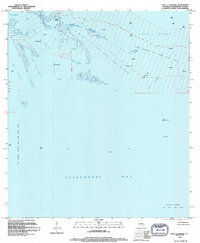
1994 Map of Lake La Graisse
USGS Topo · Published 1994About this map
Terrebonne Bay and the surrounding marshlands of Louisiana’s Gulf Coast are dominated by a massive industrial infrastructure of energy extraction in this mid-1990s survey. The map details the expansive Lake Barre Oil and Gas Field, showing a dense network of well platforms and gas wells that define the economic character of the region. This is a landscape where land and water blur, featuring tidal flats and numerous inlets like Seabreeze Pass and Barre Pass. The intricate coastal geography includes Lake La Graisse and Lake Saint Jean Baptiste, providing a clear record of the shoreline before further subsidence and erosion. Beyond the mineral resources, the map identifies specific navigation markers and landforms such as Point Meshe and Raccoon, which are essential for those studying the evolving topography of the Louisiana bayou.
Find a feature on this map
28 named features on this map. Tap any name to fly to it.
Don’t see what you’re looking for? This feature index may not catch every label — zoom into the map to look around manually.
Map Details
Editions of this 1994 Lake La Graisse Map
This is the sole edition of this map. No revisions or reprints were ever made.
Other maps of this area

1894 · Timbalier
USGS Topo · 1:62,500

1894 · Lake Felicity
USGS Topo · 1:62,500

1894 · Dulac
USGS Topo · 1:62,500

1935 · Cocodrie
USGS Topo · 1:31,680

1935 · Bourbeux
USGS Topo · 1:31,680

1935 · Timbalier Island
USGS Topo · 1:31,680

1935 · Lake Quitman
USGS Topo · 1:31,680

1939 · Lake Felicity
USGS Topo · 1:62,500

1941 · Lake Felicity
USGS Topo · 1:62,500

1941 · Dulac
USGS Topo · 1:62,500