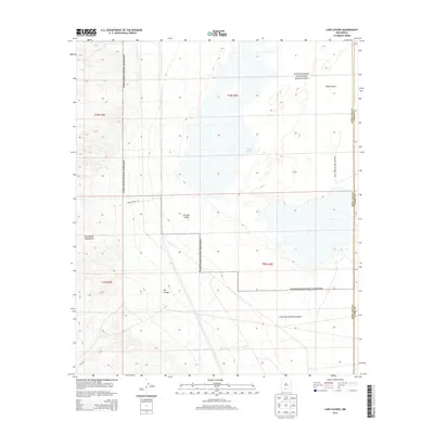
2013 Map of Lake Lucero
USGS Topo · Published 2013About this map
Lake Lucero dominates this desert basin where the gypsum-rich flats of White Sands meet the eastern slopes of the San Andres Mountains. This 2013 survey illustrates the stark hydrology of the Tularosa Valley, showing how seasonal drainage through Ash Canyon and Little San Nicholas Canyon feeds the ephemeral lakebed. The map highlights the sprawling boundary of White Sands National Monument, which encompasses much of the playa and its surrounding dune fields. Restricted access is noted by the presence of WSMR S Route 287, reflecting the area's ongoing significance for military testing. The rugged transition between high mountain peaks and the low-lying alkali flats creates a distinct landscape where geological processes and federal land management intersect along the Doña Ana and Otero County line.
Find a feature on this map
13 named features on this map. Tap any name to fly to it.
Don’t see what you’re looking for? This feature index may not catch every label — zoom into the map to look around manually.
Map Details
Editions of this 2013 Lake Lucero Map
This is the sole edition of this map. No revisions or reprints were ever made.
Other maps of this area

1916 · Tonuco
USGS Topo · 1:125,000

1916 · Point Of Sands
USGS Topo · 1:125,000

1932 · Tonuco
USGS Topo · 1:125,000

1947 · Point Of Sands 2
USGS Topo · 1:62,500

1947 · Lake Lucero
USGS Topo · 1:62,500

1948 · Bear Peak
USGS Topo · 1:62,500

1948 · Kaylor Mountain
USGS Topo · 1:62,500

1948 · Lake Lucero
USGS Topo · 1:24,000

1948 · Lake Lucero SW
USGS Topo · 1:24,000

1948 · Lake Lucero SE
USGS Topo · 1:24,000