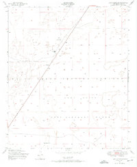
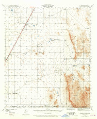
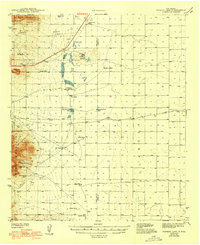
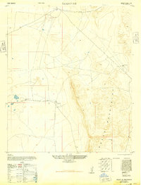
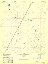
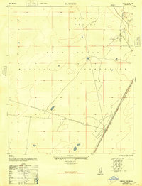
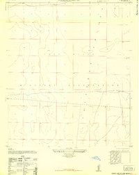
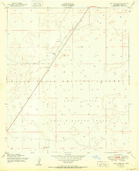
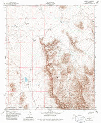
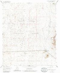
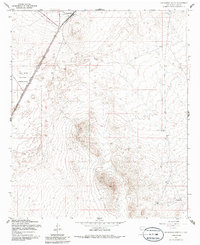
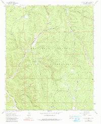
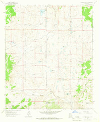
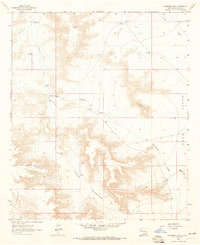
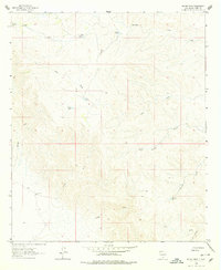
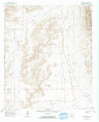
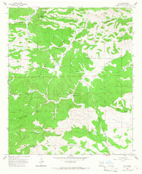
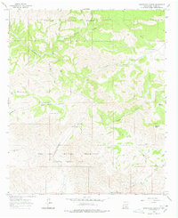
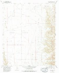
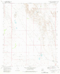
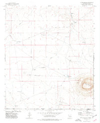
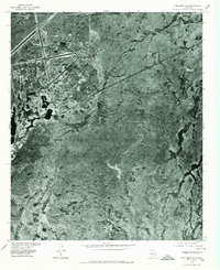
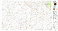
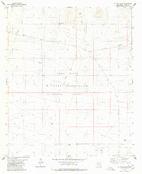
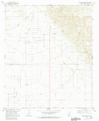
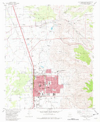
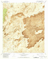
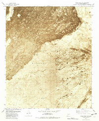
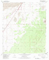
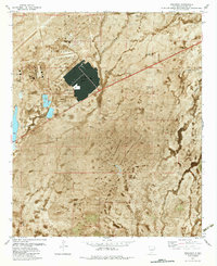
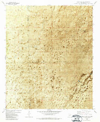
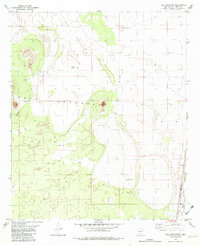
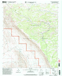
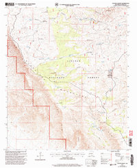
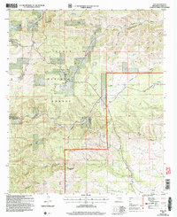
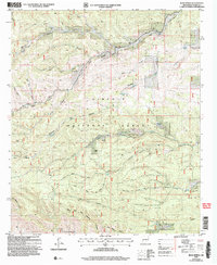
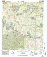
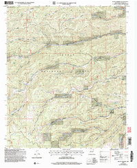
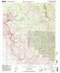
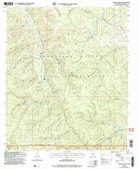
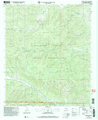
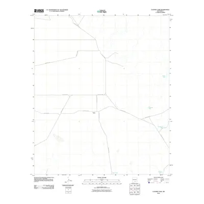
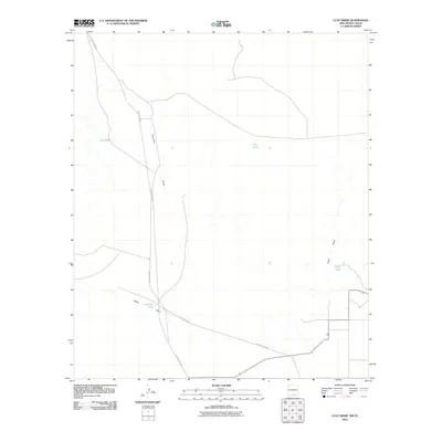
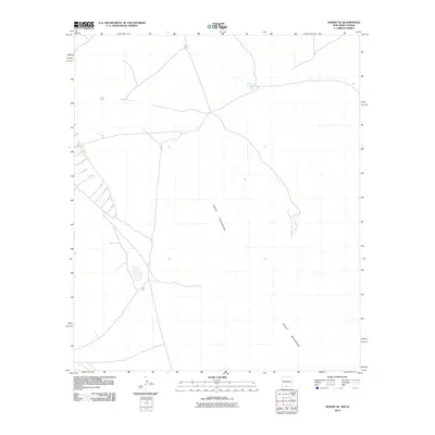
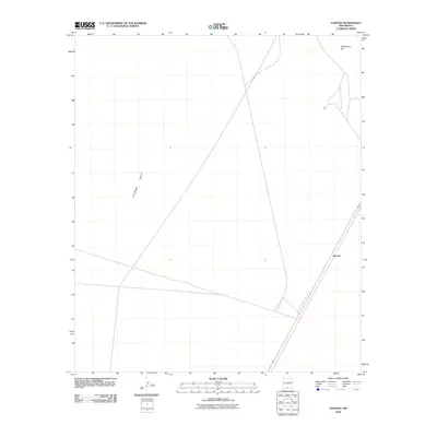
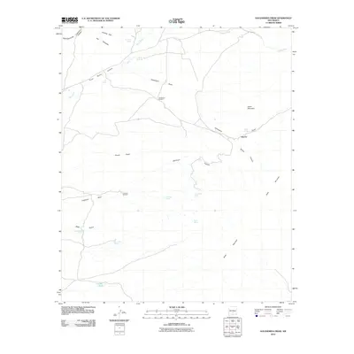
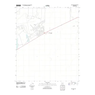
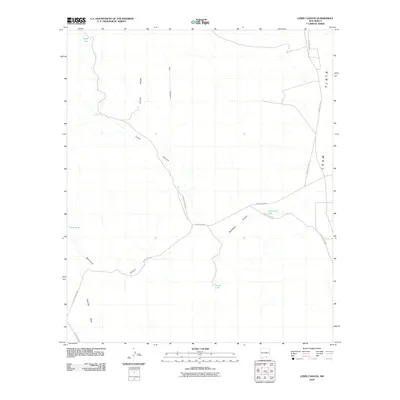
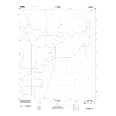
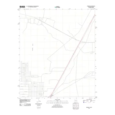
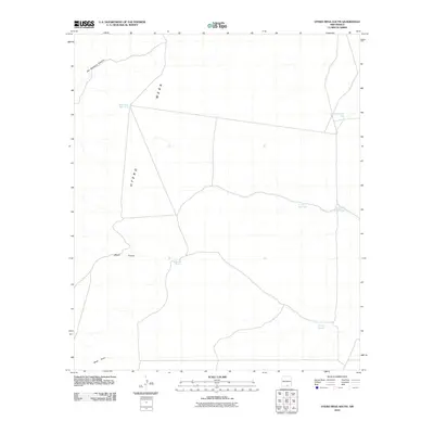
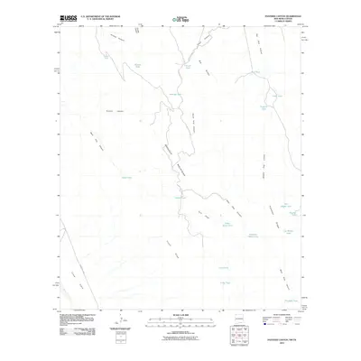
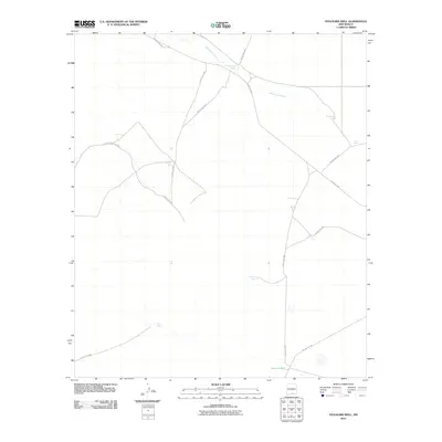
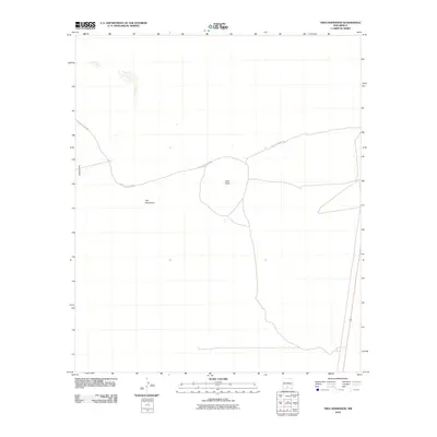
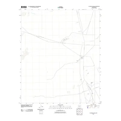
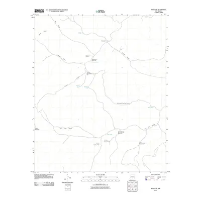
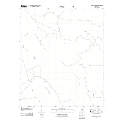
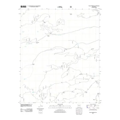
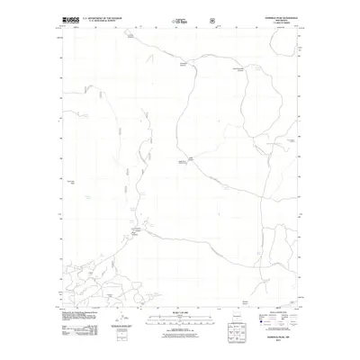
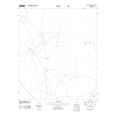
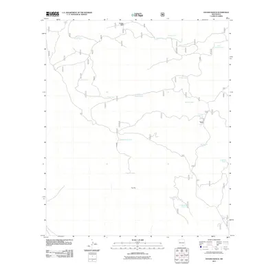
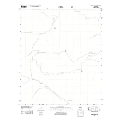
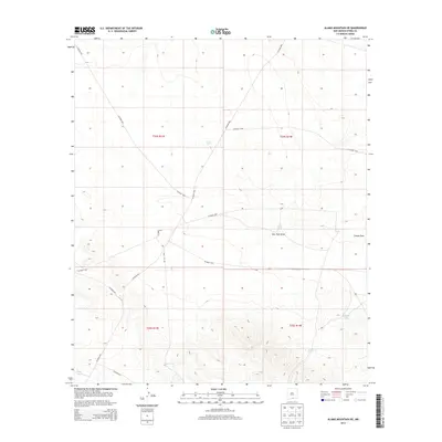
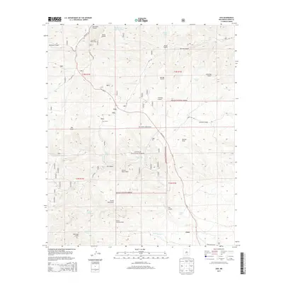
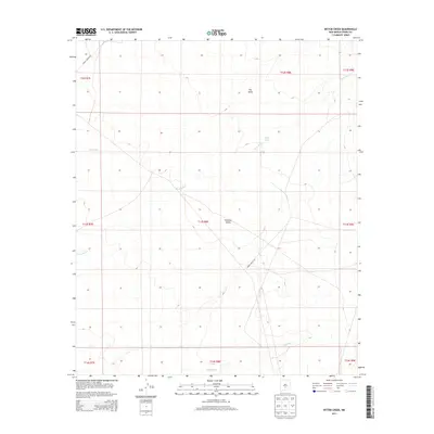
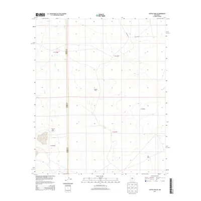
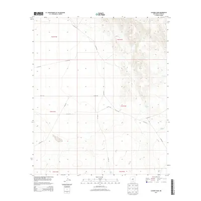
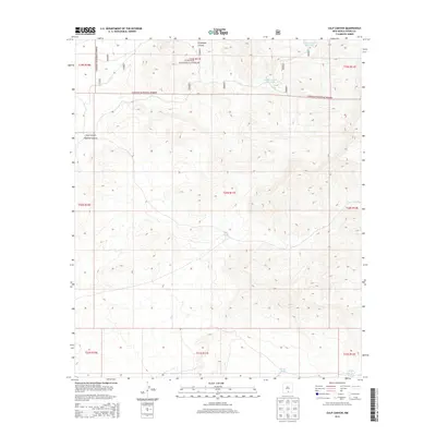
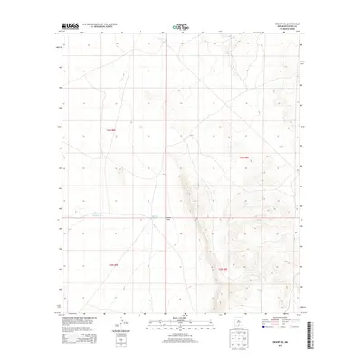
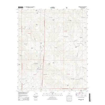
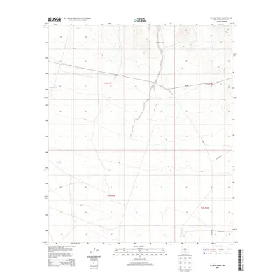
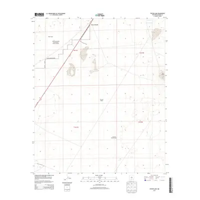
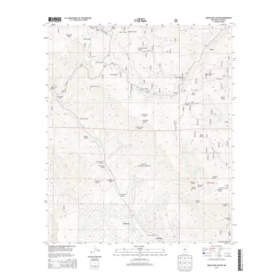
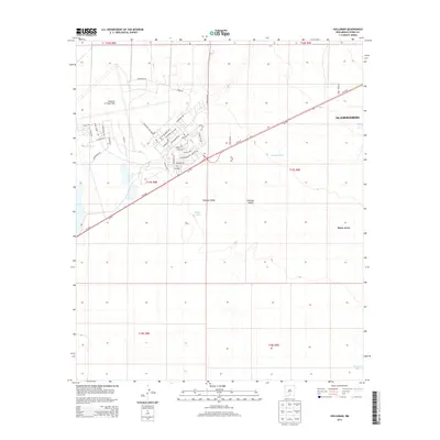
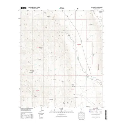
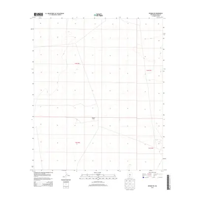
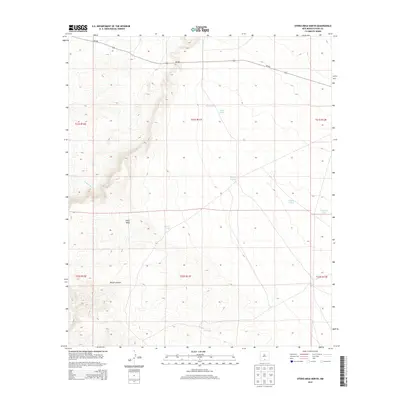
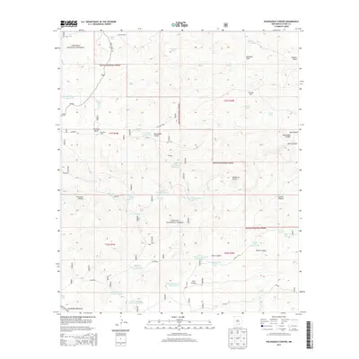
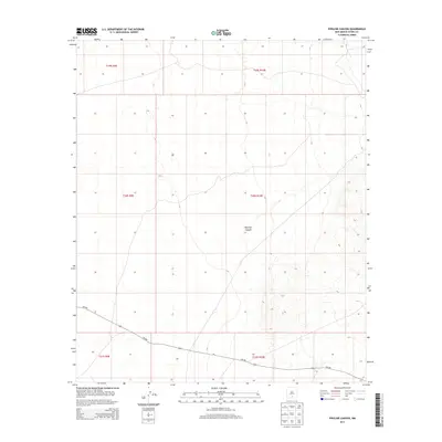
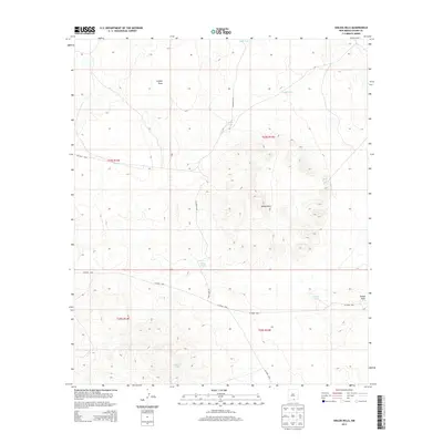
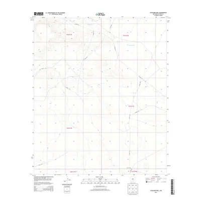
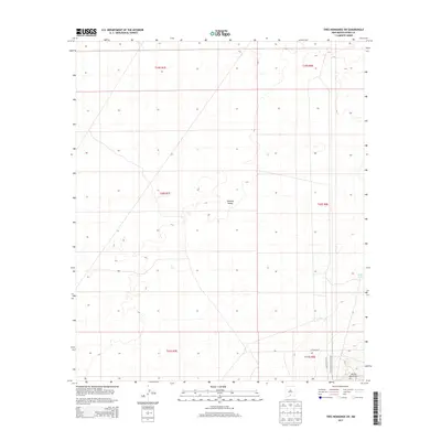
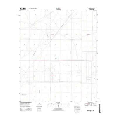
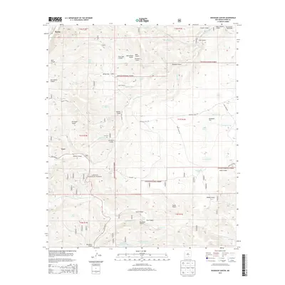
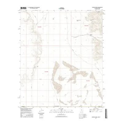
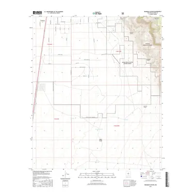
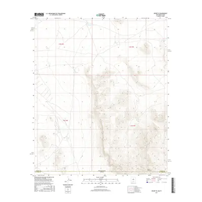
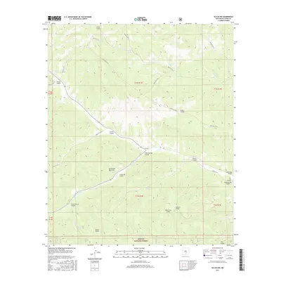
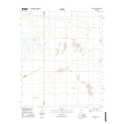
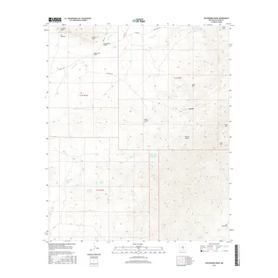
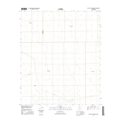
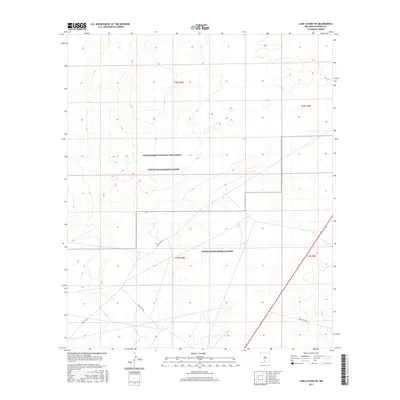
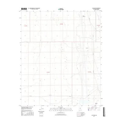
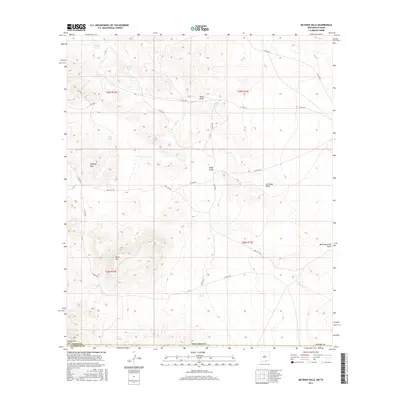
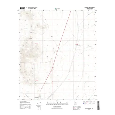
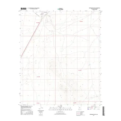
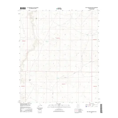
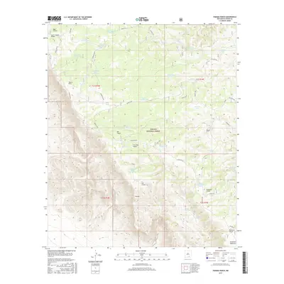
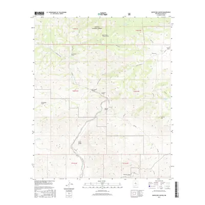
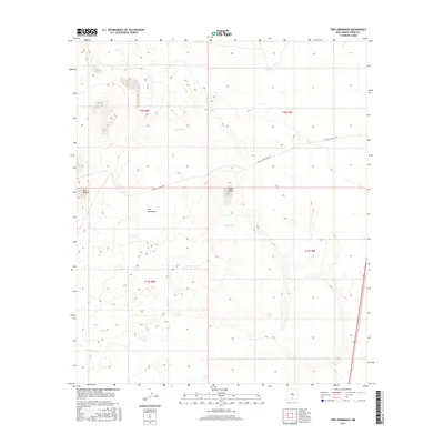
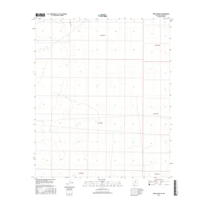
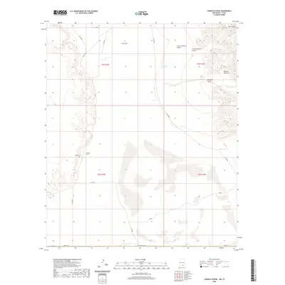
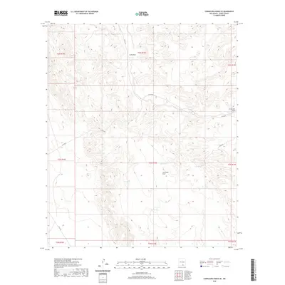
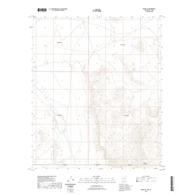
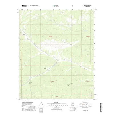
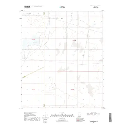
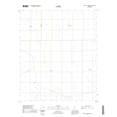
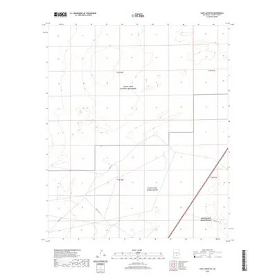
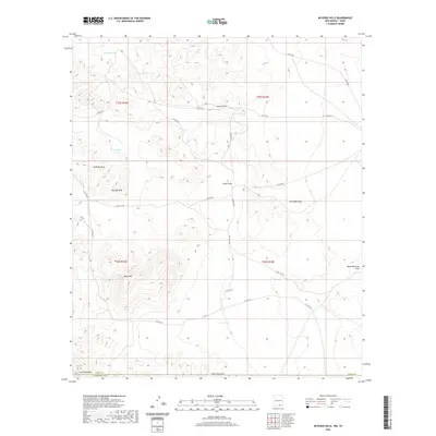
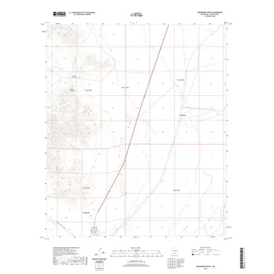
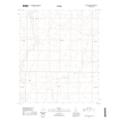
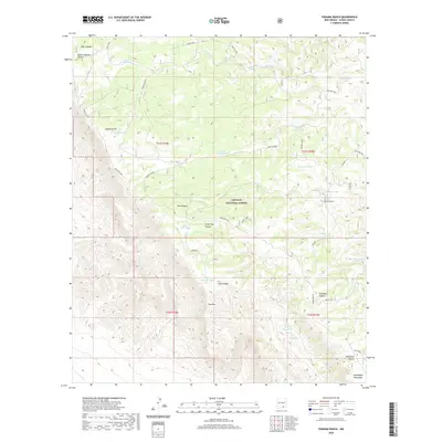
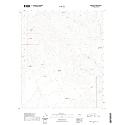
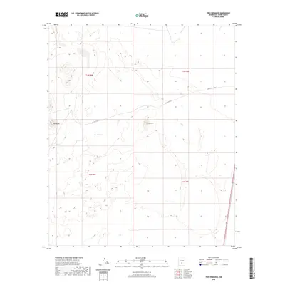
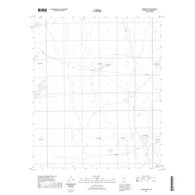
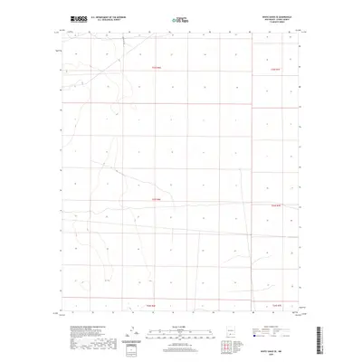
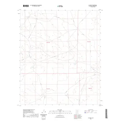
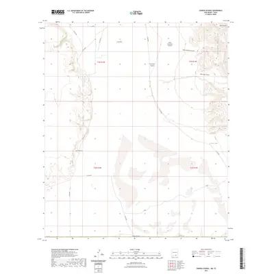
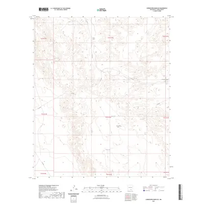
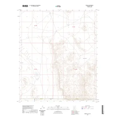
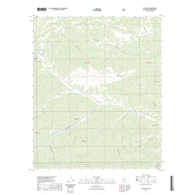
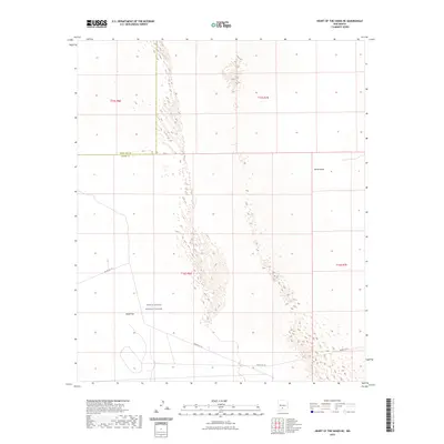
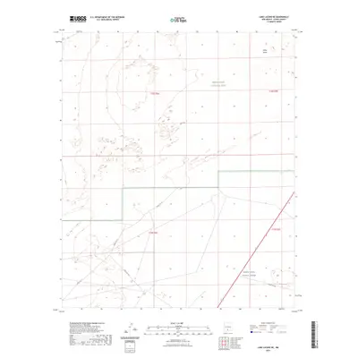
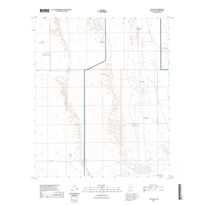
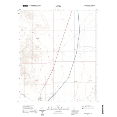
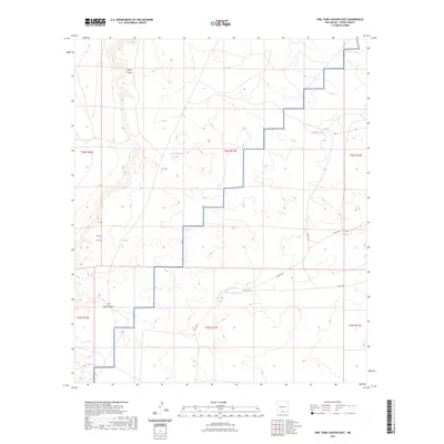
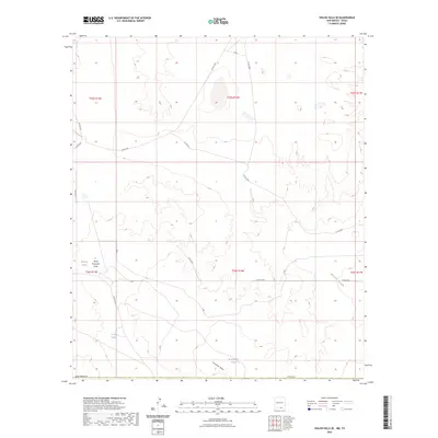
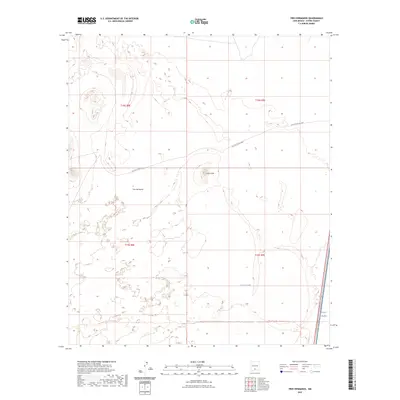
1948 Map of Lake Lucero SE
USGS Topo · Published 1974About this map
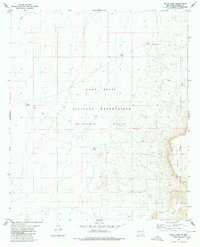
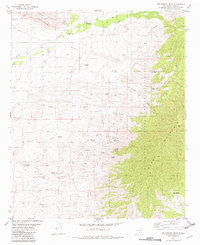
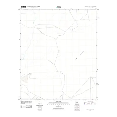
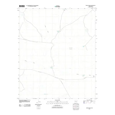
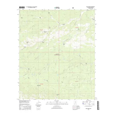
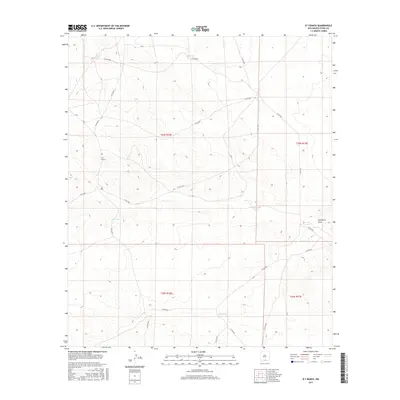
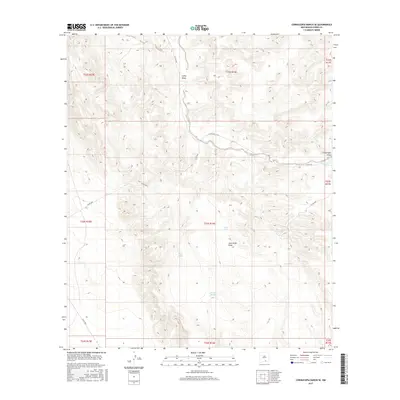
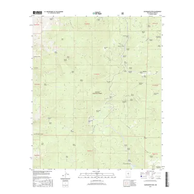
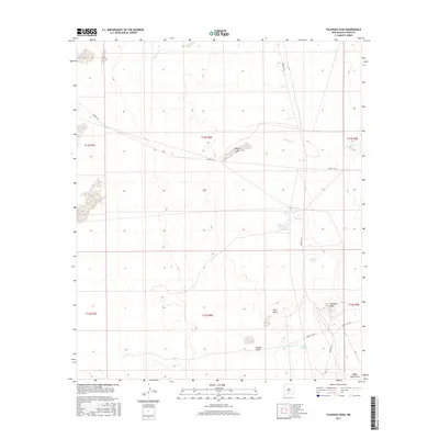
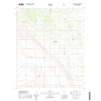
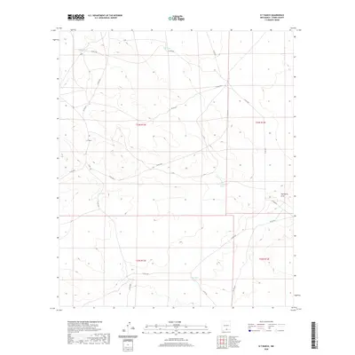
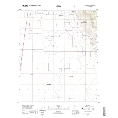
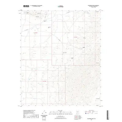
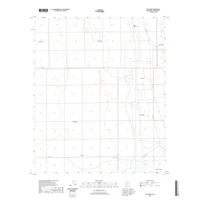
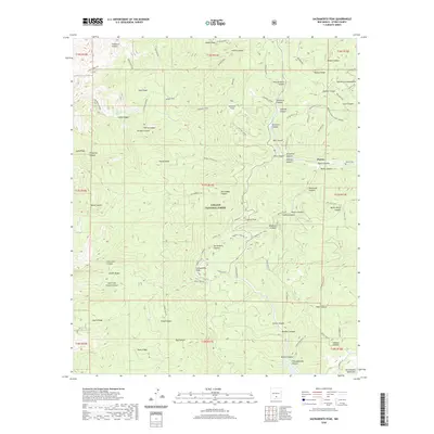
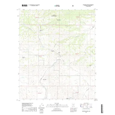
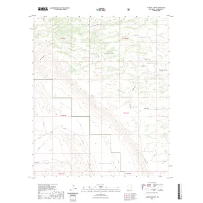
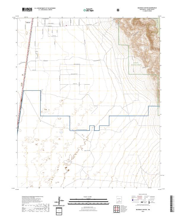
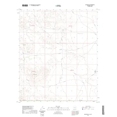
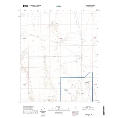
White Sands Proving Ground and the Fort Bliss Anti-Aircraft Range dominate this desert landscape as it appeared just after the war. The map provides a detailed view of the high-stakes military geography in the Tularosa Basin, where surveying and aerial photography from 1946 and 1948 document a region dedicated to tactical development and defense. Amidst the specialized training grounds, water sources like Burch Tank, Dousette Tank, and the lone Windmill Water reveal the essential infrastructure required to support operations in this arid environment. Further south, Tompson Reservoir marks a significant catchment point. This survey reflects the early Cold War era when this portion of Otero County became a focal point for aerospace and weapons testing, showing the transition of once-open range into restricted military airspace and proving grounds.
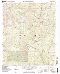
Find a feature on this map
9 named features on this map. Tap any name to fly to it.
Don’t see what you’re looking for? This feature index may not catch every label — zoom into the map to look around manually.
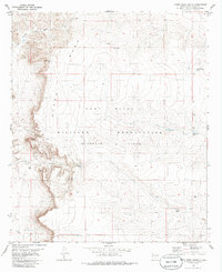
Map Details
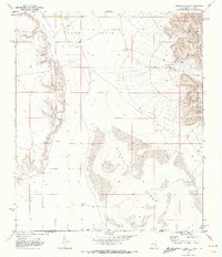
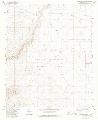
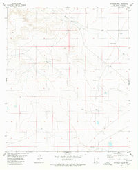
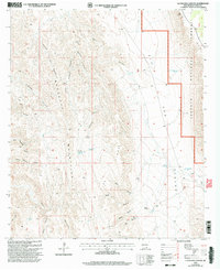
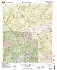
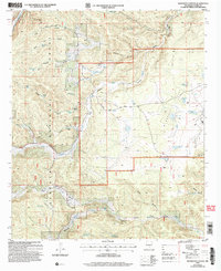
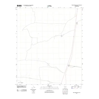
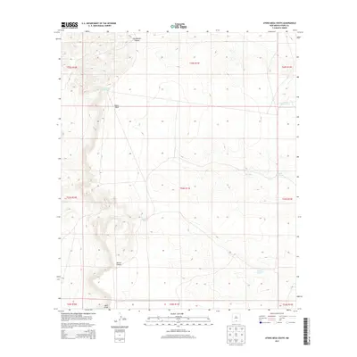
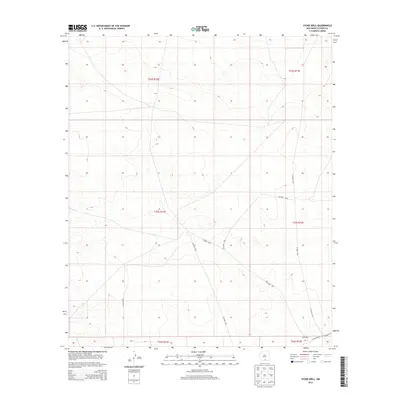
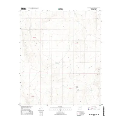
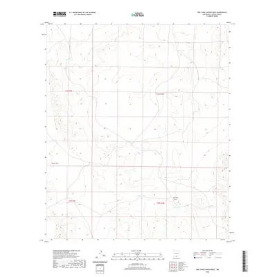
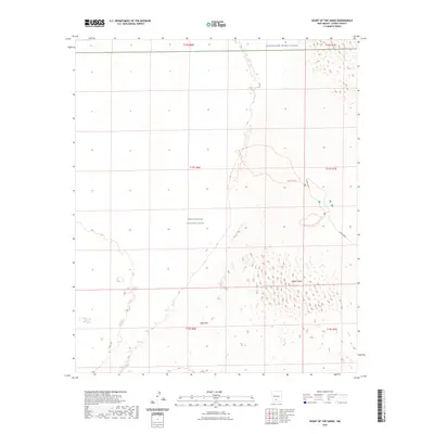
Editions of this 1948 Lake Lucero SE Map
This is the sole edition of this map. No revisions or reprints were ever made.
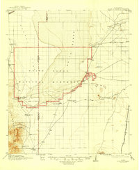
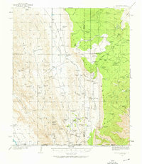
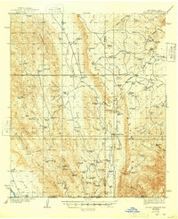
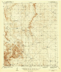
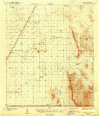
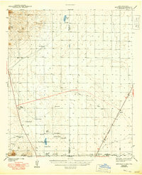
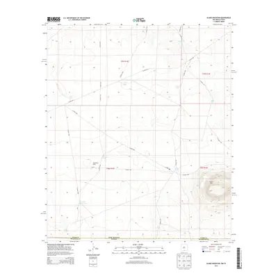
Historical Maps of Otero County Through Time
635 maps found
1916 Point Of Sands
Otero County, NM
1935 El Paso Gap
Otero County, NM

1936 El Paso Gap
Otero County, NM

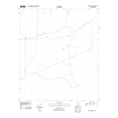
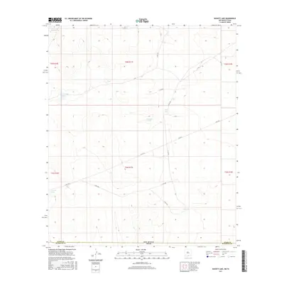
1940 Bassett Lake
Otero County, NM
1940 El Paso Gap
Otero County, NM

1940 Newman
Otero County, NM
1941 Desert
Otero County, NM
1943 Bassett Lake
Otero County, NM
1943 Desert
Otero County, NM
1943 Newman
Otero County, NM
1943 Parker Lake
Otero County, NM
1943 Pendejo Wash
Otero County, NM
1943 Texas Hill
Otero County, NM
1945 Texas Hill
Otero County, NM
1947 Desert NE
Otero County, NM
1947 Lake Lucero
Otero County, NM
1947 Orogrande North
Otero County, NM
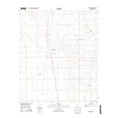
1947 Three Rivers
Otero County, NM
1948 Desert
Otero County, NM
1948 Desert SE
Otero County, NM
1948 Desert SW
Otero County, NM
1948 Elephant Mountain
Otero County, NM
1948 El Wood
Otero County, NM
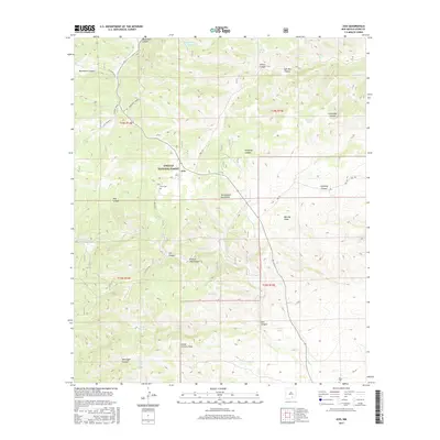
1948 Holloman
Otero County, NM
1948 Lake Lucero SE
Otero County, NM
1948 Orogrande South
Otero County, NM
1948 Parker Lake NE
Otero County, NM
1948 Parker Lake SE
Otero County, NM
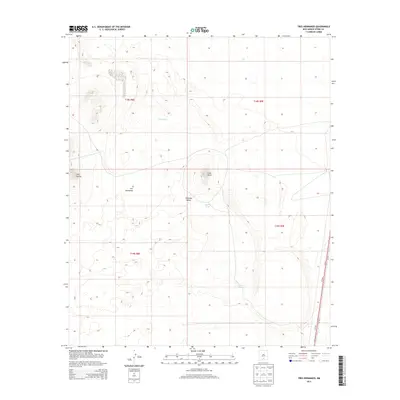
1948 Tres Hermanos
Otero County, NM
1950 Escondido Canyon
Otero County, NM
1950 Lake Lucero NE
Otero County, NM
1950 Lake Lucero SE
Otero County, NM
1950 Sierra Blanca Peak
Otero County, NM
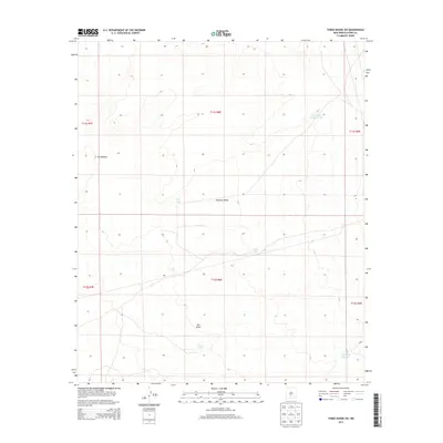
1950 Three Rivers
Otero County, NM
1954 Tucson Spring
Otero County, NM
1955 Desert NE
Otero County, NM
1955 Desert
Otero County, NM
1955 Desert SE
Otero County, NM
1955 Desert SW
Otero County, NM
1955 Elephant Mountain
Otero County, NM
1955 Elwood
Otero County, NM
1955 Newman NE
Otero County, NM

1955 Newman
Otero County, NM
1955 Orogrande North
Otero County, NM
1955 Orogrande South
Otero County, NM
1955 White Sands NE
Otero County, NM
1955 White Sands SE
Otero County, NM
1959 Alamo Mountain
Otero County, NM
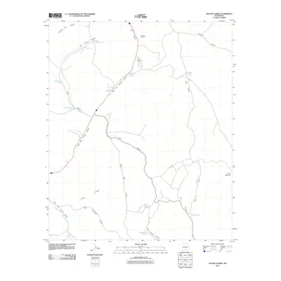
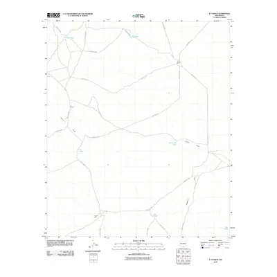
1963 Apache Summit
Otero County, NM
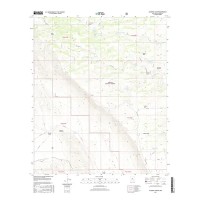
1963 Clements Ranch
Otero County, NM
1963 Cleones Tank
Otero County, NM
1963 Cornucopia Ranch SE
Otero County, NM
1963 Deadman Lake
Otero County, NM
1963 Elk-Silver
Otero County, NM
1963 Firman Canyon
Otero County, NM
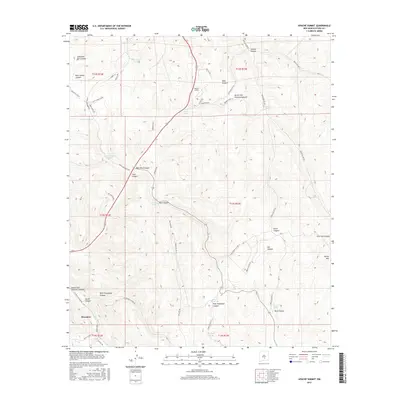
1963 Gowdy Ranch
Otero County, NM
1963 Hackberry Hill
Otero County, NM
1963 Indian Draw
Otero County, NM
1963 Pajarita Mountain
Otero County, NM
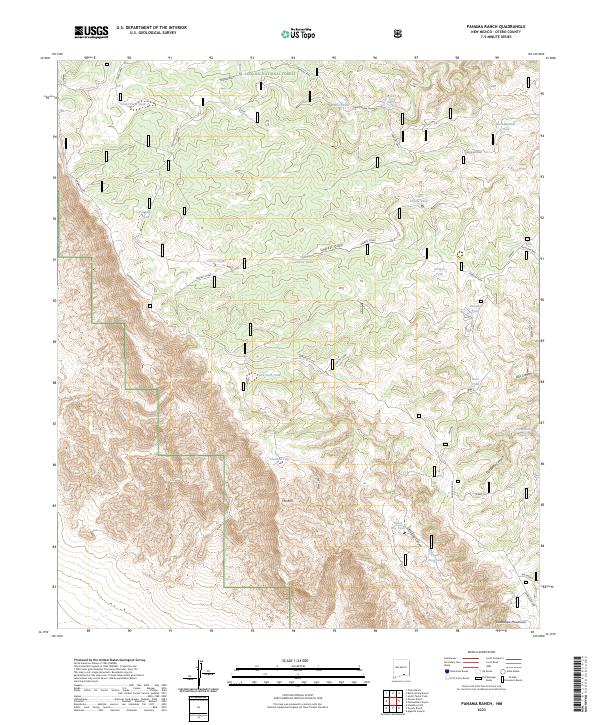
1963 Panama Ranch
Otero County, NM
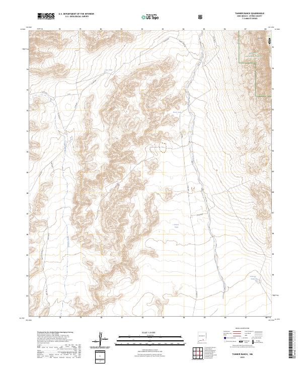
1963 Tanner Ranch
Otero County, NM
1963 Turkey Peak
Otero County, NM
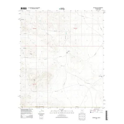
1963 Whitetail
Otero County, NM
1963 Woodson Canyon
Otero County, NM
1965 Avis
Otero County, NM
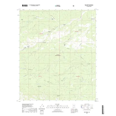
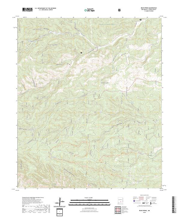
1965 Bear Spring
Otero County, NM
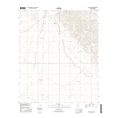
1965 El Paso Canyon
Otero County, NM
1965 Rogers Ruins
Otero County, NM
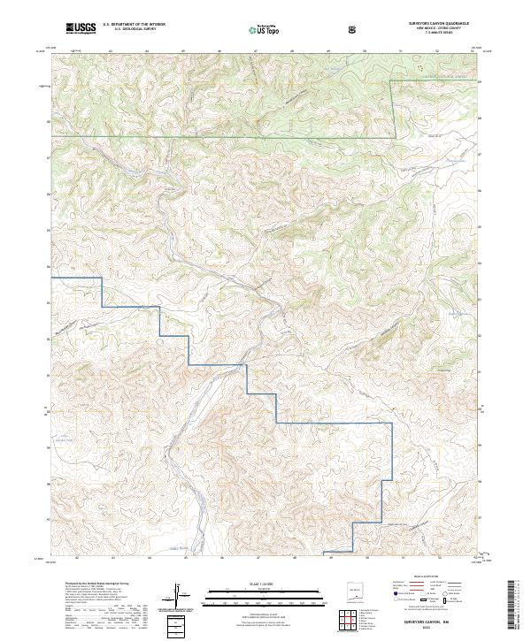
1965 Surveyors Canyon
Otero County, NM
1969 Cienega School
Otero County, NM
1969 Culp Draw
Otero County, NM
1969 Lewis Canyon
Otero County, NM
1969 Sheep Draw
Otero County, NM
1970 Mc Veigh Hills
Otero County, NM
1970 Shiloh Hills
Otero County, NM
1970 Shiloh Hills SE
Otero County, NM
1970 Van Winkle Lake
Otero County, NM
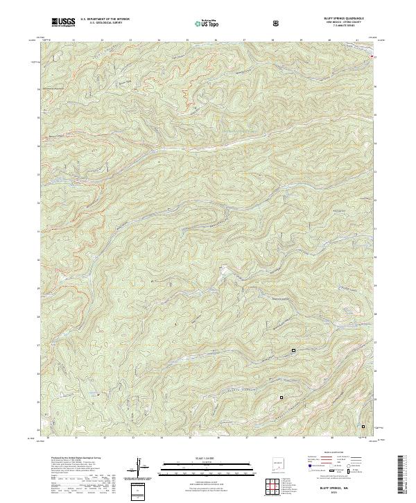
1974 Bluff Springs
Otero County, NM
1974 Harvey Ranch
Otero County, NM
1975 Alamo Mountain NE
Otero County, NM
1975 Alamo Mountain
Otero County, NM
1975 B T Ranch
Otero County, NM
1975 Cornudas Mountain
Otero County, NM
1976 Holloman NE
Otero County, NM
1976 Holloman SE
Otero County, NM
1976 Holloman SW
Otero County, NM
1976 Mule Peak
Otero County, NM
1976 Tres Hermanos NW
Otero County, NM
1979 Crow Flats
Otero County, NM
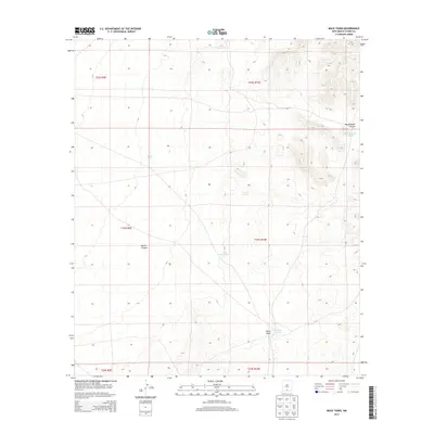
1979 Mack Tanks
Otero County, NM
1979 Otero Mesa South
Otero County, NM
1980 Bassett Lake
Otero County, NM
1980 El Paso Draw
Otero County, NM

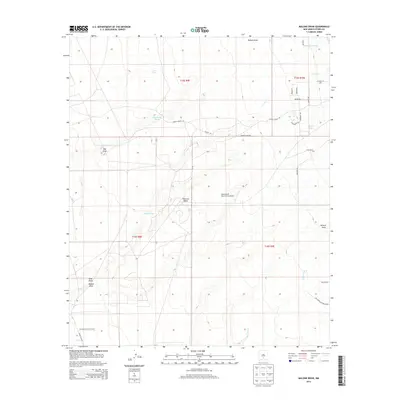
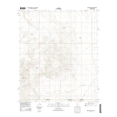
1980 Mountain Tank
Otero County, NM
1980 Otero Mesa North
Otero County, NM
1980 Owl Tank Canyon East
Otero County, NM
1980 Owl Tank Canyon West
Otero County, NM
1980 Sixteen Canyon
Otero County, NM
1980 Stockard Well
Otero County, NM
1980 Stone Well
Otero County, NM
1980 Wilde Tank
Otero County, NM
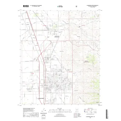
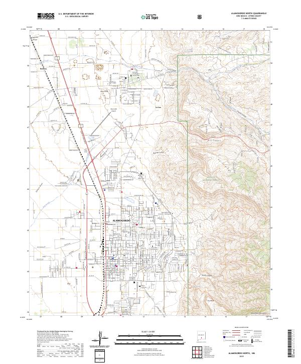
1981 Alamogordo North
Otero County, NM
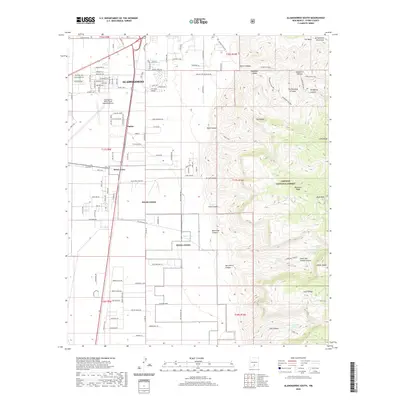
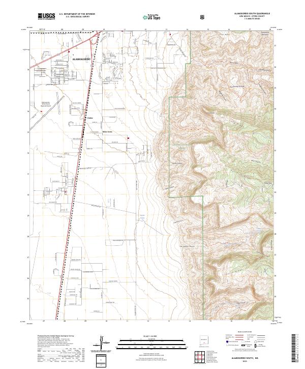
1981 Alamogordo South
Otero County, NM
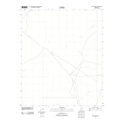
1981 Bitter Creek
Otero County, NM
1981 Bug Scuffle Canyon
Otero County, NM
1981 Capitol Peak SE
Otero County, NM
1981 Cat Mountain
Otero County, NM
1981 Culp Canyon
Otero County, NM
1981 Deadman Canyon
Otero County, NM
1981 Golondrina Draw
Otero County, NM
1981 Malone Draw
Otero County, NM
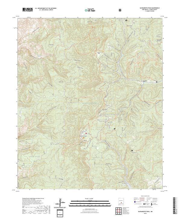
1981 Sacramento Peak
Otero County, NM
1981 Three Rivers
Otero County, NM
1981 Three Rivers SW
Otero County, NM
1981 Tularosa Peak
Otero County, NM
1982 Domingo Peak
Otero County, NM
1982 Fifteenmile Lake
Otero County, NM
1982 Foster Lake
Otero County, NM
1982 Garton Lake
Otero County, NM
1982 Heart of the Sands NE
Otero County, NM
1982 Heart of the Sands
Otero County, NM
1982 Holloman
Otero County, NM
1982 Lake Lucero NE
Otero County, NM
1982 Lake Lucero SE
Otero County, NM
1982 Lost River
Otero County, NM
1982 Lumley Lake NE
Otero County, NM
1982 Pipeline Canyon
Otero County, NM
1982 Sabinata Flat
Otero County, NM
1982 Sierra Blanca Peak
Otero County, NM
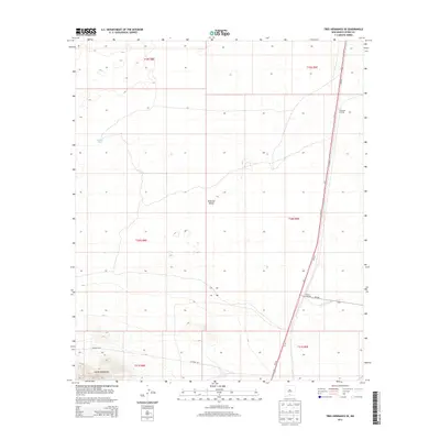
1982 Tres Hermanos
Otero County, NM
1982 Tres Hermanos SE
Otero County, NM
1982 Tres Hermanos SW
Otero County, NM
1982 Tularosa NE
Otero County, NM
2001 Algerita Canyon
Otero County, NM
2001 Gowdy Ranch
Otero County, NM
2001 La Paloma Canyon
Otero County, NM
2001 Packsaddle Canyon
Otero County, NM
2001 Panama Ranch
Otero County, NM
2001 Tanner Ranch
Otero County, NM
2004 Alamogordo North
Otero County, NM
2004 Alamogordo South
Otero County, NM
2004 Avis
Otero County, NM
2004 Bear Spring
Otero County, NM
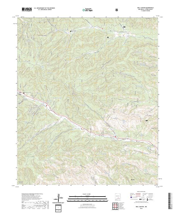
2004 Bell Canyon
Otero County, NM
2004 Bluff Springs
Otero County, NM
2004 Bug Scuffle Canyon
Otero County, NM
2004 Domingo Peak
Otero County, NM
2004 Elk-Silver
Otero County, NM
2004 El Paso Canyon
Otero County, NM
2004 Firman Canyon
Otero County, NM
2004 Graveyard Canyon
Otero County, NM
2004 Sacramento Peak
Otero County, NM
2004 Surveyors Canyon
Otero County, NM
2004 Turkey Peak
Otero County, NM
2004 Woodson Canyon
Otero County, NM
2010 Alamo Mountain NE
Otero County, NM
2010 Alamo Mountain
Otero County, NM
2010 Apache Summit
Otero County, NM
2010 Bassett Lake
Otero County, NM
2010 Bitter Creek
Otero County, NM
2010 B T Ranch
Otero County, NM
2010 Capitol Peak SE
Otero County, NM
2010 Cat Mountain
Otero County, NM
2010 Cienega School
Otero County, NM
2010 Clements Ranch
Otero County, NM
2010 Cleones Tank
Otero County, NM
2010 Cornucopia Ranch
Otero County, NM
2010 Cornucopia Ranch SE
Otero County, NM
2010 Cornudas Mountain
Otero County, NM
2010 Culp Draw
Otero County, NM
2010 Deadman Lake
Otero County, NM
2010 Desert NE
Otero County, NM
2010 Desert
Otero County, NM
2010 Desert SE
Otero County, NM
2010 Desert SW
Otero County, NM
2010 Elephant Mountain
Otero County, NM
2010 El Paso Draw
Otero County, NM
2010 Elwood
Otero County, NM
2010 Fifteenmile Lake
Otero County, NM
2010 Foster Lake
Otero County, NM
2010 Garton Lake
Otero County, NM
2010 Golondrina Draw
Otero County, NM
2010 Hackberry Hill
Otero County, NM
2010 Heart of the Sands NE
Otero County, NM
2010 Heart of the Sands
Otero County, NM
2010 Holloman
Otero County, NM
2010 Indian Draw
Otero County, NM
2010 Lake Lucero NE
Otero County, NM
2010 Lake Lucero SE
Otero County, NM
2010 Lewis Canyon
Otero County, NM
2010 Lost River
Otero County, NM
2010 Lumley Lake NE
Otero County, NM
2010 Mack Tanks
Otero County, NM
2010 Malone Draw
Otero County, NM
2010 McVeigh Hills
Otero County, NM
2010 Mountain Tank
Otero County, NM
2010 Newman NE
Otero County, NM
2010 Newman
Otero County, NM
2010 Orogrande North
Otero County, NM
2010 Orogrande South
Otero County, NM
2010 Otero Mesa North
Otero County, NM
2010 Otero Mesa South
Otero County, NM
2010 Owl Tank Canyon East
Otero County, NM
2010 Owl Tank Canyon West
Otero County, NM
2010 Pajarita Mountain
Otero County, NM
2010 Panther Canyon
Otero County, NM
2010 Pipeline Canyon
Otero County, NM
2010 Sabinata Flat
Otero County, NM
2010 Sheep Draw
Otero County, NM
2010 Shiloh Hills
Otero County, NM
2010 Shiloh Hills SE
Otero County, NM
2010 Sierra Blanca Peak
Otero County, NM
2010 Sixteen Canyon
Otero County, NM
2010 Stockard Well
Otero County, NM
2010 Stone Well
Otero County, NM
2010 Three Rivers
Otero County, NM
2010 Three Rivers SW
Otero County, NM
2010 Tres Hermanos
Otero County, NM
2010 Tres Hermanos SE
Otero County, NM
2010 Tres Hermanos SW
Otero County, NM
2010 Tularosa NE
Otero County, NM
2010 Tularosa Peak
Otero County, NM
2010 Van Winkle Lake
Otero County, NM
2010 White Sands NE
Otero County, NM
2010 White Sands SE
Otero County, NM
2010 Whitetail
Otero County, NM
2010 Wilde Tank
Otero County, NM
2011 Alamogordo North
Otero County, NM
2011 Alamogordo South
Otero County, NM
2011 Algerita Canyon
Otero County, NM
2011 Avis
Otero County, NM
2011 Bear Spring
Otero County, NM
2011 Bell Canyon
Otero County, NM
2011 Bluff Springs
Otero County, NM
2011 Bug Scuffle Canyon
Otero County, NM
2011 Culp Canyon
Otero County, NM
2011 Deadman Canyon
Otero County, NM
2011 Domingo Peak
Otero County, NM
2011 Elk-Silver
Otero County, NM
2011 El Paso Canyon
Otero County, NM
2011 Firman Canyon
Otero County, NM
2011 Gowdy Ranch
Otero County, NM
2011 Graveyard Canyon
Otero County, NM
2011 La Paloma Canyon
Otero County, NM
2011 Packsaddle Canyon
Otero County, NM
2011 Panama Ranch
Otero County, NM
2011 Sacramento Peak
Otero County, NM
2011 Surveyors Canyon
Otero County, NM
2011 Tanner Ranch
Otero County, NM
2011 Turkey Peak
Otero County, NM
2011 Woodson Canyon
Otero County, NM
2013 Alamogordo North
Otero County, NM
2013 Alamogordo South
Otero County, NM
2013 Alamo Mountain NE
Otero County, NM
2013 Alamo Mountain
Otero County, NM
2013 Algerita Canyon
Otero County, NM
2013 Apache Summit
Otero County, NM
2013 Avis
Otero County, NM
2013 Bassett Lake
Otero County, NM
2013 Bear Spring
Otero County, NM
2013 Bell Canyon
Otero County, NM
2013 Bitter Creek
Otero County, NM
2013 Bluff Springs
Otero County, NM
2013 B T Ranch
Otero County, NM
2013 Bug Scuffle Canyon
Otero County, NM
2013 Capitol Peak SE
Otero County, NM
2013 Cat Mountain
Otero County, NM
2013 Cienega School
Otero County, NM
2013 Clements Ranch
Otero County, NM
2013 Cleones Tank
Otero County, NM
2013 Cornucopia Ranch
Otero County, NM
2013 Cornucopia Ranch SE
Otero County, NM
2013 Cornudas Mountain
Otero County, NM
2013 Culp Canyon
Otero County, NM
2013 Culp Draw
Otero County, NM
2013 Deadman Canyon
Otero County, NM
2013 Deadman Lake
Otero County, NM
2013 Desert NE
Otero County, NM
2013 Desert
Otero County, NM
2013 Desert SE
Otero County, NM
2013 Desert SW
Otero County, NM
2013 Domingo Peak
Otero County, NM
2013 Elephant Mountain
Otero County, NM
2013 Elk-Silver
Otero County, NM
2013 El Paso Canyon
Otero County, NM
2013 El Paso Draw
Otero County, NM
2013 Elwood
Otero County, NM
2013 Fifteenmile Lake
Otero County, NM
2013 Firman Canyon
Otero County, NM
2013 Foster Lake
Otero County, NM
2013 Garton Lake
Otero County, NM
2013 Golondrina Draw
Otero County, NM
2013 Gowdy Ranch
Otero County, NM
2013 Graveyard Canyon
Otero County, NM
2013 Hackberry Hill
Otero County, NM
2013 Heart of the Sands NE
Otero County, NM
2013 Heart of the Sands
Otero County, NM
2013 Holloman
Otero County, NM
2013 Indian Draw
Otero County, NM
2013 Lake Lucero NE
Otero County, NM
2013 Lake Lucero SE
Otero County, NM
2013 La Paloma Canyon
Otero County, NM
2013 Lewis Canyon
Otero County, NM
2013 Lost River
Otero County, NM
2013 Lumley Lake NE
Otero County, NM
2013 Mack Tanks
Otero County, NM
2013 Malone Draw
Otero County, NM
2013 McVeigh Hills
Otero County, NM
2013 Mountain Tank
Otero County, NM
2013 Newman NE
Otero County, NM
2013 Newman
Otero County, NM
2013 Orogrande North
Otero County, NM
2013 Orogrande South
Otero County, NM
2013 Otero Mesa North
Otero County, NM
2013 Otero Mesa South
Otero County, NM
2013 Owl Tank Canyon East
Otero County, NM
2013 Owl Tank Canyon West
Otero County, NM
2013 Packsaddle Canyon
Otero County, NM
2013 Pajarita Mountain
Otero County, NM
2013 Panama Ranch
Otero County, NM
2013 Panther Canyon
Otero County, NM
2013 Pipeline Canyon
Otero County, NM
2013 Sabinata Flat
Otero County, NM
2013 Sacramento Peak
Otero County, NM
2013 Sheep Draw
Otero County, NM
2013 Shiloh Hills
Otero County, NM
2013 Shiloh Hills SE
Otero County, NM
2013 Sierra Blanca Peak
Otero County, NM
2013 Sixteen Canyon
Otero County, NM
2013 Stockard Well
Otero County, NM
2013 Stone Well
Otero County, NM
2013 Surveyors Canyon
Otero County, NM
2013 Tanner Ranch
Otero County, NM
2013 Three Rivers
Otero County, NM
2013 Three Rivers SW
Otero County, NM
2013 Tres Hermanos
Otero County, NM
2013 Tres Hermanos SE
Otero County, NM
2013 Tres Hermanos SW
Otero County, NM
2013 Tularosa NE
Otero County, NM
2013 Tularosa Peak
Otero County, NM
2013 Turkey Peak
Otero County, NM

2013 Van Winkle Lake
Otero County, NM
2013 White Sands NE
Otero County, NM
2013 White Sands SE
Otero County, NM
2013 Whitetail
Otero County, NM
2013 Wilde Tank
Otero County, NM
2013 Woodson Canyon
Otero County, NM
2017 Alamogordo North
Otero County, NM
2017 Alamogordo South
Otero County, NM

2017 Alamo Mountain NE
Otero County, NM
2017 Alamo Mountain
Otero County, NM
2017 Algerita Canyon
Otero County, NM
2017 Apache Summit
Otero County, NM
2017 Avis
Otero County, NM
2017 Bassett Lake
Otero County, NM
2017 Bear Spring
Otero County, NM
2017 Bell Canyon
Otero County, NM
2017 Bitter Creek
Otero County, NM
2017 Bluff Springs
Otero County, NM
2017 B T Ranch
Otero County, NM
2017 Bug Scuffle Canyon
Otero County, NM
2017 Capitol Peak SE
Otero County, NM
2017 Cat Mountain
Otero County, NM
2017 Cienega School
Otero County, NM
2017 Clements Ranch
Otero County, NM
2017 Cleones Tank
Otero County, NM
2017 Cornucopia Ranch
Otero County, NM
2017 Cornucopia Ranch SE
Otero County, NM
2017 Cornudas Mountain
Otero County, NM
2017 Culp Canyon
Otero County, NM
2017 Culp Draw
Otero County, NM
2017 Deadman Canyon
Otero County, NM
2017 Deadman Lake
Otero County, NM
2017 Desert NE
Otero County, NM
2017 Desert
Otero County, NM
2017 Desert SE
Otero County, NM
2017 Desert SW
Otero County, NM
2017 Domingo Peak
Otero County, NM
2017 Elephant Mountain
Otero County, NM
2017 Elk-Silver
Otero County, NM
2017 El Paso Canyon
Otero County, NM
2017 El Paso Draw
Otero County, NM
2017 Elwood
Otero County, NM
2017 Fifteenmile Lake
Otero County, NM
2017 Firman Canyon
Otero County, NM
2017 Foster Lake
Otero County, NM
2017 Garton Lake
Otero County, NM
2017 Golondrina Draw
Otero County, NM
2017 Gowdy Ranch
Otero County, NM
2017 Graveyard Canyon
Otero County, NM
2017 Hackberry Hill
Otero County, NM
2017 Heart of the Sands NE
Otero County, NM
2017 Heart of the Sands
Otero County, NM
2017 Holloman
Otero County, NM
2017 Indian Draw
Otero County, NM
2017 Lake Lucero NE
Otero County, NM
2017 Lake Lucero SE
Otero County, NM
2017 La Paloma Canyon
Otero County, NM
2017 Lewis Canyon
Otero County, NM
2017 Lost River
Otero County, NM
2017 Lumley Lake NE
Otero County, NM
2017 Mack Tanks
Otero County, NM
2017 Malone Draw
Otero County, NM
2017 McVeigh Hills
Otero County, NM
2017 Mountain Tank
Otero County, NM
2017 Newman NE
Otero County, NM
2017 Newman
Otero County, NM
2017 Orogrande North
Otero County, NM
2017 Orogrande South
Otero County, NM
2017 Otero Mesa North
Otero County, NM
2017 Otero Mesa South
Otero County, NM
2017 Owl Tank Canyon East
Otero County, NM
2017 Owl Tank Canyon West
Otero County, NM
2017 Packsaddle Canyon
Otero County, NM
2017 Pajarita Mountain
Otero County, NM
2017 Panama Ranch
Otero County, NM
2017 Panther Canyon
Otero County, NM
2017 Pipeline Canyon
Otero County, NM
2017 Sabinata Flat
Otero County, NM
2017 Sacramento Peak
Otero County, NM
2017 Sheep Draw
Otero County, NM
2017 Shiloh Hills
Otero County, NM
2017 Shiloh Hills SE
Otero County, NM
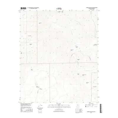
2017 Sierra Blanca Peak
Otero County, NM
2017 Sixteen Canyon
Otero County, NM
2017 Stockard Well
Otero County, NM
2017 Stone Well
Otero County, NM
2017 Surveyors Canyon
Otero County, NM
2017 Tanner Ranch
Otero County, NM
2017 Three Rivers
Otero County, NM
2017 Three Rivers SW
Otero County, NM
2017 Tres Hermanos
Otero County, NM
2017 Tres Hermanos SE
Otero County, NM
2017 Tres Hermanos SW
Otero County, NM
2017 Tularosa NE
Otero County, NM
2017 Tularosa Peak
Otero County, NM
2017 Turkey Peak
Otero County, NM
2017 Van Winkle Lake
Otero County, NM
2017 White Sands NE
Otero County, NM
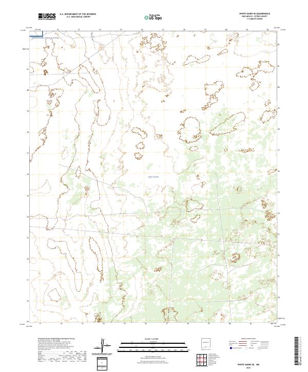
2017 White Sands SE
Otero County, NM
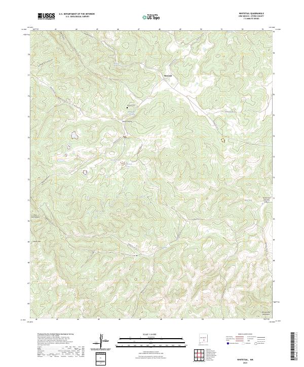
2017 Whitetail
Otero County, NM
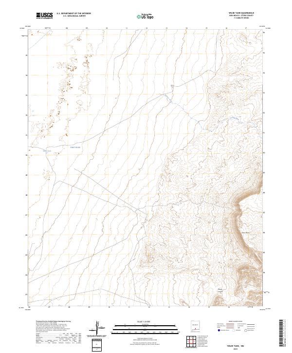
2017 Wilde Tank
Otero County, NM
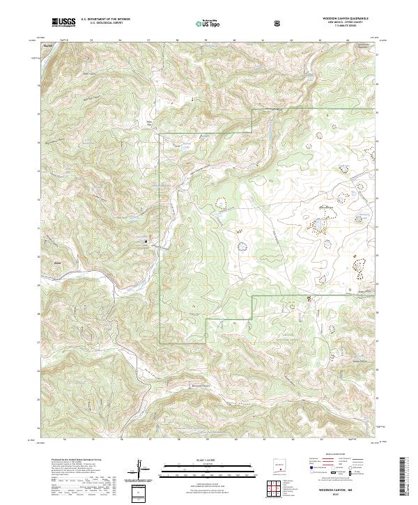
2017 Woodson Canyon
Otero County, NM
2020 Alamogordo North
Otero County, NM
2020 Alamogordo South
Otero County, NM
2020 Alamo Mountain NE
Otero County, NM
2020 Alamo Mountain
Otero County, NM
2020 Algerita Canyon
Otero County, NM
2020 Apache Summit
Otero County, NM
2020 Avis
Otero County, NM
2020 Bassett Lake
Otero County, NM
2020 Bear Spring
Otero County, NM
2020 Bell Canyon
Otero County, NM
2020 Bitter Creek
Otero County, NM
2020 Bluff Springs
Otero County, NM
2020 B T Ranch
Otero County, NM
2020 Bug Scuffle Canyon
Otero County, NM
2020 Capitol Peak SE
Otero County, NM
2020 Cat Mountain
Otero County, NM
2020 Cienega School
Otero County, NM
2020 Clements Ranch
Otero County, NM
2020 Cleones Tank
Otero County, NM
2020 Cornucopia Ranch
Otero County, NM
2020 Cornucopia Ranch SE
Otero County, NM
2020 Cornudas Mountain
Otero County, NM
2020 Culp Canyon
Otero County, NM
2020 Culp Draw
Otero County, NM
2020 Deadman Canyon
Otero County, NM
2020 Deadman Lake
Otero County, NM
2020 Desert NE
Otero County, NM
2020 Desert
Otero County, NM
2020 Desert SE
Otero County, NM
2020 Desert SW
Otero County, NM
2020 Domingo Peak
Otero County, NM
2020 Elephant Mountain
Otero County, NM
2020 Elk-Silver
Otero County, NM
2020 El Paso Canyon
Otero County, NM
2020 El Paso Draw
Otero County, NM
2020 Elwood
Otero County, NM
2020 Fifteenmile Lake
Otero County, NM
2020 Firman Canyon
Otero County, NM
2020 Foster Lake
Otero County, NM
2020 Garton Lake
Otero County, NM
2020 Golondrina Draw
Otero County, NM
2020 Gowdy Ranch
Otero County, NM
2020 Graveyard Canyon
Otero County, NM
2020 Hackberry Hill
Otero County, NM
2020 Heart of the Sands NE
Otero County, NM
2020 Heart of the Sands
Otero County, NM
2020 Holloman
Otero County, NM
2020 Indian Draw
Otero County, NM
2020 Lake Lucero NE
Otero County, NM
2020 Lake Lucero SE
Otero County, NM
2020 La Paloma Canyon
Otero County, NM
2020 Lewis Canyon
Otero County, NM
2020 Lost River
Otero County, NM
2020 Lumley Lake NE
Otero County, NM
2020 Mack Tanks
Otero County, NM
2020 Malone Draw
Otero County, NM
2020 McVeigh Hills
Otero County, NM
2020 Mountain Tank
Otero County, NM
2020 Newman NE
Otero County, NM
2020 Newman
Otero County, NM
2020 Orogrande North
Otero County, NM
2020 Orogrande South
Otero County, NM
2020 Otero Mesa North
Otero County, NM
2020 Otero Mesa South
Otero County, NM
2020 Owl Tank Canyon East
Otero County, NM
2020 Owl Tank Canyon West
Otero County, NM
2020 Packsaddle Canyon
Otero County, NM
2020 Pajarita Mountain
Otero County, NM
2020 Panama Ranch
Otero County, NM
2020 Panther Canyon
Otero County, NM
2020 Pipeline Canyon
Otero County, NM
2020 Sabinata Flat
Otero County, NM
2020 Sacramento Peak
Otero County, NM
2020 Sheep Draw
Otero County, NM
2020 Shiloh Hills
Otero County, NM
2020 Shiloh Hills SE
Otero County, NM
2020 Sierra Blanca Peak
Otero County, NM
2020 Sixteen Canyon
Otero County, NM
2020 Stockard Well
Otero County, NM
2020 Stone Well
Otero County, NM
2020 Surveyors Canyon
Otero County, NM
2020 Tanner Ranch
Otero County, NM
2020 Three Rivers
Otero County, NM
2020 Three Rivers SW
Otero County, NM
2020 Tres Hermanos
Otero County, NM
2020 Tres Hermanos SE
Otero County, NM
2020 Tres Hermanos SW
Otero County, NM
2020 Tularosa NE
Otero County, NM
2020 Tularosa Peak
Otero County, NM
2020 Turkey Peak
Otero County, NM
2020 Van Winkle Lake
Otero County, NM
2020 White Sands NE
Otero County, NM
2020 White Sands SE
Otero County, NM
2020 Whitetail
Otero County, NM
2020 Wilde Tank
Otero County, NM
2020 Woodson Canyon
Otero County, NM
2023 Alamogordo North
Otero County, NM
2023 Alamogordo South
Otero County, NM
2023 Alamo Mountain NE
Otero County, NM
2023 Alamo Mountain
Otero County, NM
2023 Algerita Canyon
Otero County, NM
2023 Apache Summit
Otero County, NM
2023 Avis
Otero County, NM
2023 Bassett Lake
Otero County, NM
2023 Bear Spring
Otero County, NM
2023 Bell Canyon
Otero County, NM
2023 Bitter Creek
Otero County, NM
2023 Bluff Springs
Otero County, NM
2023 B T Ranch
Otero County, NM
2023 Bug Scuffle Canyon
Otero County, NM
2023 Capitol Peak SE
Otero County, NM
2023 Cat Mountain
Otero County, NM
2023 Cienega School
Otero County, NM
2023 Clements Ranch
Otero County, NM
2023 Cleones Tank
Otero County, NM
2023 Cornucopia Ranch
Otero County, NM
2023 Cornucopia Ranch SE
Otero County, NM
2023 Cornudas Mountain
Otero County, NM
2023 Culp Canyon
Otero County, NM
2023 Culp Draw
Otero County, NM
2023 Deadman Canyon
Otero County, NM
2023 Deadman Lake
Otero County, NM
2023 Desert NE
Otero County, NM
2023 Desert
Otero County, NM
2023 Desert SE
Otero County, NM
2023 Desert SW
Otero County, NM
2023 Domingo Peak
Otero County, NM
2023 Elephant Mountain
Otero County, NM
2023 Elk-Silver
Otero County, NM
2023 El Paso Canyon
Otero County, NM
2023 El Paso Draw
Otero County, NM
2023 Elwood
Otero County, NM
2023 Fifteenmile Lake
Otero County, NM
2023 Firman Canyon
Otero County, NM
2023 Foster Lake
Otero County, NM
2023 Garton Lake
Otero County, NM
2023 Golondrina Draw
Otero County, NM
2023 Gowdy Ranch
Otero County, NM
2023 Graveyard Canyon
Otero County, NM
2023 Hackberry Hill
Otero County, NM
2023 Heart of the Sands NE
Otero County, NM
2023 Heart of the Sands
Otero County, NM
2023 Holloman
Otero County, NM
2023 Indian Draw
Otero County, NM
2023 Lake Lucero NE
Otero County, NM
2023 Lake Lucero SE
Otero County, NM
2023 La Paloma Canyon
Otero County, NM
2023 Lewis Canyon
Otero County, NM
2023 Lost River
Otero County, NM
2023 Lumley Lake NE
Otero County, NM
2023 Mack Tanks
Otero County, NM
2023 Malone Draw
Otero County, NM
2023 McVeigh Hills
Otero County, NM
2023 Mountain Tank
Otero County, NM
2023 Newman NE
Otero County, NM
2023 Newman
Otero County, NM
2023 Orogrande North
Otero County, NM
2023 Orogrande South
Otero County, NM
2023 Otero Mesa North
Otero County, NM
2023 Otero Mesa South
Otero County, NM
2023 Owl Tank Canyon East
Otero County, NM
2023 Owl Tank Canyon West
Otero County, NM
2023 Packsaddle Canyon
Otero County, NM
2023 Pajarita Mountain
Otero County, NM
2023 Panama Ranch
Otero County, NM
2023 Panther Canyon
Otero County, NM
2023 Pipeline Canyon
Otero County, NM
2023 Sabinata Flat
Otero County, NM
2023 Sacramento Peak
Otero County, NM
2023 Sheep Draw
Otero County, NM
2023 Shiloh Hills
Otero County, NM
2023 Shiloh Hills SE
Otero County, NM
2023 Sierra Blanca Peak
Otero County, NM
2023 Sixteen Canyon
Otero County, NM
2023 Stockard Well
Otero County, NM
2023 Stone Well
Otero County, NM
2023 Surveyors Canyon
Otero County, NM
2023 Tanner Ranch
Otero County, NM
2023 Three Rivers
Otero County, NM
2023 Three Rivers SW
Otero County, NM
2023 Tres Hermanos
Otero County, NM
2023 Tres Hermanos SE
Otero County, NM
2023 Tres Hermanos SW
Otero County, NM
2023 Tularosa NE
Otero County, NM
2023 Tularosa Peak
Otero County, NM
2023 Turkey Peak
Otero County, NM
2023 Van Winkle Lake
Otero County, NM
2023 White Sands NE
Otero County, NM
2023 White Sands SE
Otero County, NM
2023 Whitetail
Otero County, NM
2023 Wilde Tank
Otero County, NM
2023 Woodson Canyon
Otero County, NM