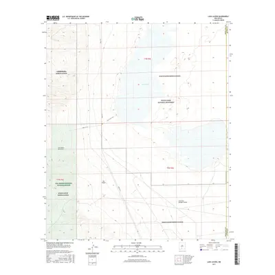
2017 Map of Lake Lucero
USGS Topo · Published 2017About this map
Lake Lucero serves as the focal point of this arid landscape, situated within a complex overlap of conservation and military jurisdictions. The area is dominated by the White Sands Missile Range, which encompasses both the White Sands National Monument and the San Andres National Wildlife Refuge. The terrain transitions from the salt crusts and playa of the lake bed to the steep elevations of the San Andres Mountains to the west. Access is limited to specialized routes like the Lake Lucero Trail and military roads including Wsmr S RT 287. Deep topographical incisions such as Ash Canyon and Little San Nicholas Canyon drain the mountain slopes toward the basin floor, illustrating the stark hydrology of the Tularosa Basin during the late 2010s.
Find a feature on this map
14 named features on this map. Tap any name to fly to it.
Don’t see what you’re looking for? This feature index may not catch every label — zoom into the map to look around manually.
Map Details
Editions of this 2017 Lake Lucero Map
This is the sole edition of this map. No revisions or reprints were ever made.
Other maps of this area

1916 · Tonuco
USGS Topo · 1:125,000

1916 · Point Of Sands
USGS Topo · 1:125,000

1932 · Tonuco
USGS Topo · 1:125,000

1947 · Point Of Sands 2
USGS Topo · 1:62,500

1947 · Lake Lucero
USGS Topo · 1:62,500

1948 · Bear Peak
USGS Topo · 1:62,500

1948 · Kaylor Mountain
USGS Topo · 1:62,500

1948 · Lake Lucero
USGS Topo · 1:24,000

1948 · Lake Lucero SW
USGS Topo · 1:24,000

1948 · Lake Lucero SE
USGS Topo · 1:24,000