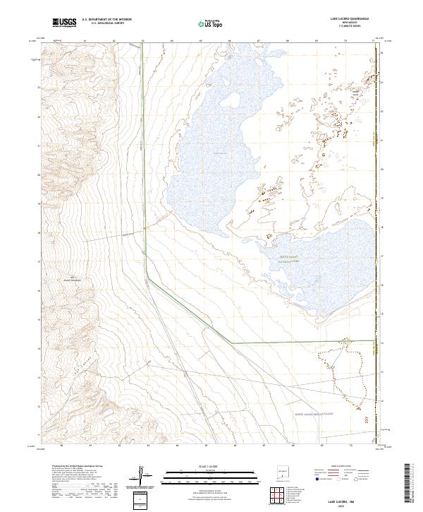
2023 Map of Lake Lucero
USGS Topo · Published 2023About this map
Lake Lucero sits as a central topographic focus where the gypsum-rich basin floor meets the steep western elevations of the San Andres Mountains. This modern survey illustrates the specialized land management of the Tularosa Basin, where the boundaries of White Sands National Park intersect with the expansive White Sands Missile Range. The terrain transitions from the stark, alkaline flats of the White Sands to the rugged drainage of Ash Canyon in the southwest. Access is strictly defined by military and conservation perimeters, featuring specialized routes such as Wsmr P RT 7 and the Lake Lucero Trail. The map also captures the protected environment of the San Andres National Wildlife Refuge, emphasizing the isolation and distinct geological character of this desert interior.
Find a feature on this map
19 named features on this map. Tap any name to fly to it.
Don’t see what you’re looking for? This feature index may not catch every label — zoom into the map to look around manually.
Map Details
Editions of this 2023 Lake Lucero Map
This is the sole edition of this map. No revisions or reprints were ever made.
Other maps of this area

1916 · Tonuco
USGS Topo · 1:125,000

1916 · Point Of Sands
USGS Topo · 1:125,000

1932 · Tonuco
USGS Topo · 1:125,000

1947 · Point Of Sands 2
USGS Topo · 1:62,500

1947 · Lake Lucero
USGS Topo · 1:62,500

1948 · Bear Peak
USGS Topo · 1:62,500

1948 · Kaylor Mountain
USGS Topo · 1:62,500

1948 · Lake Lucero
USGS Topo · 1:24,000

1948 · Lake Lucero SW
USGS Topo · 1:24,000

1948 · Lake Lucero SE
USGS Topo · 1:24,000