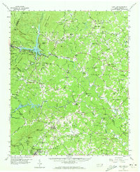
1959 Map of Lake Lure
USGS Topo · Published 1973About this map
Lake Lure and the winding Broad River anchor this topographic survey, which reveals the complex mountain terrain of western North Carolina during the late 1950s. The map illustrates a landscape transitioning from the dramatic cliffs of Chimney Rock and Rumbling Bald Mtn to the agricultural valleys of Mill Spring. Dozens of local landmarks appear, including the Mullen Bible Sch, Camp Occoneechee, and numerous rural sanctuaries such as St Johns Ch and Piney Knob Ch.
Find a feature on this map
123 named features on this map. Tap any name to fly to it.
Don’t see what you’re looking for? This feature index may not catch every label — zoom into the map to look around manually.
Map Details
Editions of this 1959 Lake Lure Map
2 editions found

Other maps of this area

1900 · Mount Mitchell
USGS Topo · 1:125,000

1902 · Mount Mitchell
USGS Topo · 1:125,000

1905 · Morganton
USGS Topo · 1:125,000

1907 · Saluda
USGS Topo · 1:125,000

1935 · Batcave
USGS Topo · 1:24,000

1935 · Black Mountain
USGS Topo · 1:24,000

1935 · Fishtop
USGS Topo · 1:24,000

1941 · Black Mountain
USGS Topo · 1:24,000
1943 · Black Mountain
USGS Topo · 1:24,000

1946 · Bat Cave
USGS Topo · 1:24,000