
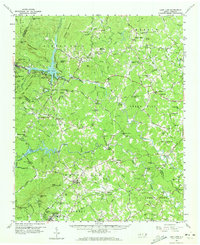
1959 Map of Lake Lure
USGS Topo · Published 1960About this map
Lake Lure and the Broad River valley dominate this late 1950s landscape, illustrating the intersection of natural river systems and mid-century hydroelectric development. The terrain is marked by significant elevations like Chimney Rock and Rumbling Bald Mtn, which frame the deep waters of the lake. In the rural valleys, a dense network of country roads connects family-named landmarks and local centers of worship, including St Johns Ch and Big Level Ch.
Find a feature on this map
108 named features on this map. Tap any name to fly to it.
Don’t see what you’re looking for? This feature index may not catch every label — zoom into the map to look around manually.
Map Details
Editions of this 1959 Lake Lure Map
2 editions found
Other maps of this area

1900 · Mount Mitchell
USGS Topo · 1:125,000

1902 · Mount Mitchell
USGS Topo · 1:125,000

1905 · Morganton
USGS Topo · 1:125,000

1907 · Saluda
USGS Topo · 1:125,000

1935 · Batcave
USGS Topo · 1:24,000

1935 · Black Mountain
USGS Topo · 1:24,000

1935 · Fishtop
USGS Topo · 1:24,000

1941 · Black Mountain
USGS Topo · 1:24,000
1943 · Black Mountain
USGS Topo · 1:24,000

1946 · Bat Cave
USGS Topo · 1:24,000