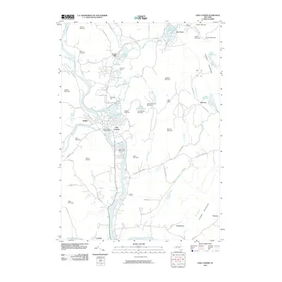
2010 Map of Lake Luzerne
USGS Topo · Published 2010About this map
The Hudson River carves a deep valley through the southern Adirondacks on this 2010 map, marking the confluence with the Sacandaga River near the village of Hadley. This area is characterized by its numerous glacial lakes, including Fourth Lake, Third Lake, Second Lake, and the recreational hub of Lake Luzerne. Notable for its local history, the map preserves the locations of several burial grounds such as the Old Methodist Cemetery and Leavens Cemetery. The transition from river-level industry to the high peaks of the Luzerne Mountains is evident, with landmarks like the Lake Luzerne Seaplane Base and Bend of the River Golf Course highlighting the region's enduring appeal as a seasonal destination.
Find a feature on this map
82 named features on this map. Tap any name to fly to it.
Don’t see what you’re looking for? This feature index may not catch every label — zoom into the map to look around manually.
Map Details
Editions of this 2010 Lake Luzerne Map
This is the sole edition of this map. No revisions or reprints were ever made.
Other maps of this area

1895 · Glens Falls
USGS Topo · 1:62,500

1897 · Glens Falls
USGS Topo · 1:62,500

1900 · Schuylerville
USGS Topo · 1:62,500

1902 · Saratoga
USGS Topo · 1:62,500

1903 · Luzerne
USGS Topo · 1:62,500

1935 · Gansevoort
USGS Topo · 1:24,000

1935 · Corinth
USGS Topo · 1:24,000

1938 · Glens Falls
USGS Topo · 1:62,500
1940 · Schuylerville
USGS Topo · 1:62,500

1942 · Saratoga
USGS Topo · 1:62,500