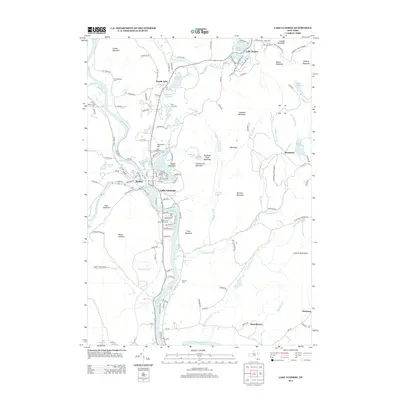
2013 Map of Lake Luzerne
USGS Topo · Published 2013About this map
Lake Luzerne and Hadley serve as the focal points of this 2013 survey, situated at the confluence of the Hudson River and the Sacandaga River. This intersection of water and terrain is marked by a series of peaks including Cobble Mountain and Rockwell Hill, while the surrounding landscape is defined by the protected lands of the Adirondack Park Preserve. Local genealogy and land use patterns are visible through established burial grounds such as Old Methodist Cem and the Rockwell Falls Lake Luzerne Cem. North of the main settlements, a chain of water bodies including Second Lake, Third Lake, and Fourth Lake transitions into more isolated communities like Beartown and Pine Log Camp. The southern portion of the map follows the winding Hudson River toward Danielstown and Hartman, showing a network of rural roads and mountain brooks.
Find a feature on this map
145 named features on this map. Tap any name to fly to it.
Don’t see what you’re looking for? This feature index may not catch every label — zoom into the map to look around manually.
Map Details
Editions of this 2013 Lake Luzerne Map
This is the sole edition of this map. No revisions or reprints were ever made.
Other maps of this area

1895 · Glens Falls
USGS Topo · 1:62,500

1897 · Glens Falls
USGS Topo · 1:62,500

1900 · Schuylerville
USGS Topo · 1:62,500

1902 · Saratoga
USGS Topo · 1:62,500

1903 · Luzerne
USGS Topo · 1:62,500

1935 · Gansevoort
USGS Topo · 1:24,000

1935 · Corinth
USGS Topo · 1:24,000

1938 · Glens Falls
USGS Topo · 1:62,500
1940 · Schuylerville
USGS Topo · 1:62,500

1942 · Saratoga
USGS Topo · 1:62,500