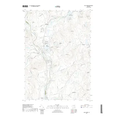
2019 Map of Lake Luzerne
USGS Topo · Published 2019About this map
The confluence of the Hudson River and the Sacandaga River defines the geography of this southern Adirondack region, where the villages of Hadley and Lake Luzerne sit on opposite banks. These settlements are anchored by historic landmarks such as Rockwell Hill and several ancestral burial grounds, including Old Methodist Cem and Luzerne Cem. The landscape rises sharply from the river valleys toward prominent peaks like Bucktail Mtn and Cobble Mtn, while the eastern portion of the map is characterized by the upland drainage of Anderson Brook and Clendon Brook. Smaller communities like Beartown, Danielstown, and Hartman are scattered through the hills, connected by mountain roads that trace the complex terrain. The presence of the Luzerne Reservoir and Wilkie Reservoir suggests the area's role in local water management, while the vast Ninemile Swamp occupies a low-lying basin to the south.
Find a feature on this map
126 named features on this map. Tap any name to fly to it.
Don’t see what you’re looking for? This feature index may not catch every label — zoom into the map to look around manually.
Map Details
Editions of this 2019 Lake Luzerne Map
This is the sole edition of this map. No revisions or reprints were ever made.
Other maps of this area

1895 · Glens Falls
USGS Topo · 1:62,500

1897 · Glens Falls
USGS Topo · 1:62,500

1900 · Schuylerville
USGS Topo · 1:62,500

1902 · Saratoga
USGS Topo · 1:62,500

1903 · Luzerne
USGS Topo · 1:62,500

1935 · Gansevoort
USGS Topo · 1:24,000

1935 · Corinth
USGS Topo · 1:24,000

1938 · Glens Falls
USGS Topo · 1:62,500
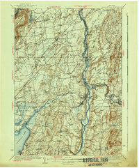
1940 · Schuylerville
USGS Topo · 1:62,500

1942 · Saratoga
USGS Topo · 1:62,500