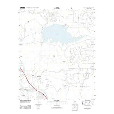
2012 Map of Lake Mathews
USGS Topo · Published 2012About this map
Lake Mathews serves as the central focal point of this Inland Empire landscape, defined by its massive water storage and engineering infrastructure including the Cajalco Tunnel and Mathews Dike. The surrounding terrain transitions from the residential developments along La Sierra Ave and Vista Del Lago Dr to the more open, high-elevation points of Arington Mountain and Estelle Mountain. South of the reservoir, the map documents a mix of agricultural and recreation-oriented land use, featuring the Gavilan Springs Ranch and the resort-adjacent community of Glen Ivy Hot Springs. Along the western edge, the path of the Temescal Wash cuts through a corridor of industry and old settlements like Arcilla and Temescal. This 2012 survey provides a clear view of the suburban interface with the Gavilan Plateau, where rural properties like the Diamond B Ranch sit near the growing residential fringes of Riverside County.
Find a feature on this map
105 named features on this map. Tap any name to fly to it.
Don’t see what you’re looking for? This feature index may not catch every label — zoom into the map to look around manually.
Map Details
Editions of this 2012 Lake Mathews Map
This is the sole edition of this map. No revisions or reprints were ever made.
Other maps of this area

1901 · Southern California Sheet No. 1
USGS Topo · 1:250,000

1901 · Elsinore
USGS Topo · 1:125,000

1901 · Riverside
USGS Topo · 1:62,500

1902 · Corona
USGS Topo · 1:125,000

1904 · Southern California Sheet No. 1
USGS Topo · 1:250,000

1942 · Lake Elsinore
USGS Topo · 1:62,500

1942 · Corona and Vicinity
USGS Topo · 1:31,680

1942 · Riverside and Vicinity
USGS Topo · 1:31,680

1942 · Santiago Peak
USGS Topo · 1:62,500

1942 · Corona
USGS Topo · 1:62,500