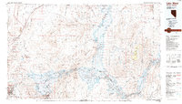
1987 Map of Lake Mead
USGS Topo · Published 1988About this map
Valley of Fire State Park and the expansive Lake Mead National Recreation Area dominate this desert landscape, where the Colorado River was transformed into a massive reservoir system. This late-1980s data highlights the intricate shoreline from Las Vegas Bay to the narrow reaches of Iceberg Canyon and Virgin Canyon. The map details the transition from the growing urban edges of Henderson and Boulder City to the stark, remote terrain of the Muddy Mountains and Gale Hills.
Find a feature on this map
50 named features on this map. Tap any name to fly to it.
Don’t see what you’re looking for? This feature index may not catch every label — zoom into the map to look around manually.
Map Details
Editions of this 1987 Lake Mead Map
This is the sole edition of this map. No revisions or reprints were ever made.
Other maps of this area

1886 · Diamond Creek
USGS Topo · 1:250,000

1886 · Camp Mohave
USGS Topo · 1:250,000

1886 · Saint Thomas
USGS Topo · 1:250,000

1886 · Mt. Trumbull
USGS Topo · 1:250,000

1892 · Diamond Creek
USGS Topo · 1:250,000

1892 · Mt. Trumbull
USGS Topo · 1:250,000

1892 · Camp Mohave
USGS Topo · 1:250,000

1893 · Saint Thomas
USGS Topo · 1:250,000

1907 · Las Vegas
USGS Topo · 1:250,000

1908 · Las Vegas
USGS Topo · 1:250,000