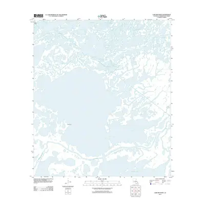
2012 Map of Lake Mechant
USGS Topo · Published 2012About this map
The marshlands of Terrebonne Parish are defined here by a complex network of coastal waterways and brackish basins just north of the Gulf of Mexico. This environment is dominated by Jug Lake and the northern reaches of Caillou Lake, connected by a web of winding natural channels such as Bayou de Cade and Small Bayou La Pointe. The presence of the Voss Canal indicates the intersection of industrial transport with the natural drainage system of the delta. Prominent land features are scarce in this saturated landscape, making landmarks like Hog Point significant for navigation. The map illustrates the contemporary state of Louisiana's fragile coastline, where major arteries like Bayou du Large serve as critical corridors through the wetlands. This record captures the intricate hydrography of the region, from the smaller Turtle Bayou to the larger tidal basins that characterize the modern bayou country.
Find a feature on this map
11 named features on this map. Tap any name to fly to it.
Don’t see what you’re looking for? This feature index may not catch every label — zoom into the map to look around manually.
Map Details
Editions of this 2012 Lake Mechant Map
This is the sole edition of this map. No revisions or reprints were ever made.
Other maps of this area

1894 · Bayou De Large
USGS Topo · 1:62,500

1932 · Lake Decade
USGS Topo · 1:62,500

1935 · Theriot
USGS Topo · 1:31,680

1935 · Lake Mechant
USGS Topo · 1:31,680

1935 · Lake Penchant
USGS Topo · 1:31,680

1935 · Oyster Bayou
USGS Topo · 1:62,500

1940 · Bayou Du Large
USGS Topo · 1:62,500

1941 · Bayou Du Large
USGS Topo · 1:62,500

1944 · Bayou Du Large
USGS Topo · 1:62,500

1945 · New Orleans
USGS Topo · 1:250,000