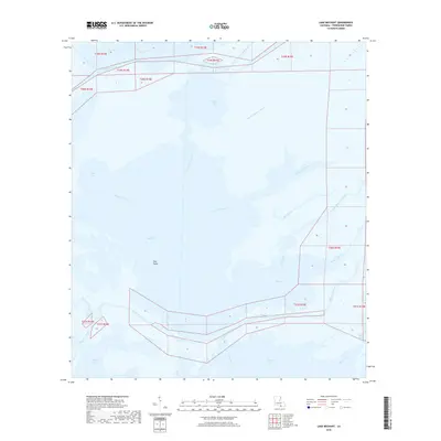
2018 Map of Lake Mechant
USGS Topo · Published 2018About this map
Lake Mechant dominates this coastal landscape in southern Terrebonne Parish, where the intricate hydrology of the Louisiana bayous meets the Gulf. The area is defined by a complex network of interconnected waterways, including the significant channel of Bayou du Large and the wide expanse of Raccourci Bay. These tidal waters are punctuated by landmarks like Hog Point and Grand Pass, which navigate the passage between Lake Mechant and Caillou Lake to the south. Small, winding distributaries such as Bayou Chevreau and Small Bayou La Pointe illustrate the fragile, shifting nature of this marshland. In the northwestern corner, the presence of the Voss Canal indicates human intervention in this water-bound environment, likely for navigation or drainage, while various bayous like Bayou De Cade and Bayou la Loutre trace the ancient paths of the deltaic plain.
Find a feature on this map
31 named features on this map. Tap any name to fly to it.
Don’t see what you’re looking for? This feature index may not catch every label — zoom into the map to look around manually.
Map Details
Editions of this 2018 Lake Mechant Map
This is the sole edition of this map. No revisions or reprints were ever made.
Other maps of this area

1894 · Bayou De Large
USGS Topo · 1:62,500

1932 · Lake Decade
USGS Topo · 1:62,500

1935 · Theriot
USGS Topo · 1:31,680

1935 · Lake Mechant
USGS Topo · 1:31,680

1935 · Lake Penchant
USGS Topo · 1:31,680

1935 · Oyster Bayou
USGS Topo · 1:62,500

1940 · Bayou Du Large
USGS Topo · 1:62,500

1941 · Bayou Du Large
USGS Topo · 1:62,500

1944 · Bayou Du Large
USGS Topo · 1:62,500

1945 · New Orleans
USGS Topo · 1:250,000