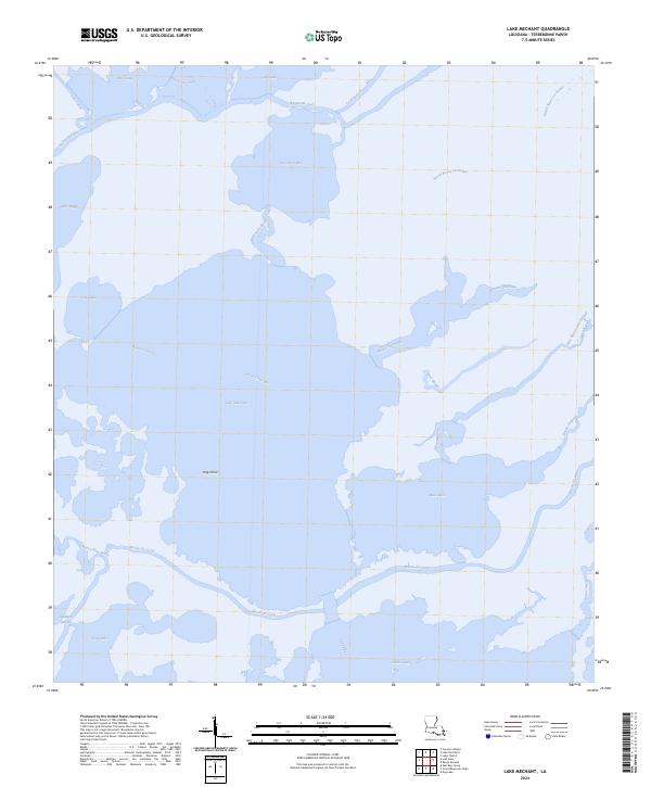
2024 Map of Lake Mechant
USGS Topo · Published 2024About this map
Lake Mechant dominates this coastal Terrebonne Parish landscape, serving as a central hub for a complex network of waterways that define the Louisiana marsh. The sheet reveals a fluid environment where larger bodies like Caillou Lake and Raccourci Bay are connected by an intricate system of bayous, including Bayou Du Cade and the long stretch of Bayou Du Large. Human intervention in this tidal terrain is visible through the straight lines of the Voss Canal, contrasting with the meandering paths of Fred Bayou and Deer Bayou. Landmarks such as Hog Point provide terrestrial orientation in an area otherwise governed by the movement of water between Goose Bay and the gulf-facing outlets of Grand Pass. This map is particularly valuable for understanding the modern shoreline and the contemporary hydrographic boundaries of the Mississippi Deltaic Plain.
Find a feature on this map
32 named features on this map. Tap any name to fly to it.
Don’t see what you’re looking for? This feature index may not catch every label — zoom into the map to look around manually.
Map Details
Editions of this 2024 Lake Mechant Map
This is the sole edition of this map. No revisions or reprints were ever made.
Other maps of this area

1894 · Bayou De Large
USGS Topo · 1:62,500

1932 · Lake Decade
USGS Topo · 1:62,500

1935 · Theriot
USGS Topo · 1:31,680

1935 · Lake Mechant
USGS Topo · 1:31,680

1935 · Lake Penchant
USGS Topo · 1:31,680

1935 · Oyster Bayou
USGS Topo · 1:62,500

1940 · Bayou Du Large
USGS Topo · 1:62,500

1941 · Bayou Du Large
USGS Topo · 1:62,500

1944 · Bayou Du Large
USGS Topo · 1:62,500

1945 · New Orleans
USGS Topo · 1:250,000