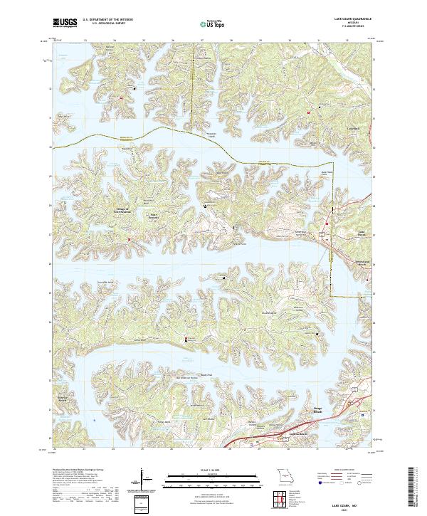
2021 Map of Lake Ozark
USGS Topo · Published 2021About this map
The irregular shoreline of the Lake of the Ozarks dominates this modern topographical study, revealing the complex residential development and vacation infrastructure of the Mid-Missouri region. The map centers on the winding Shawnee Bend, where newer communities like the Village of Four Seasons and Four Seasons sit alongside established landmarks such as the Houston Cem and Downing Cem. To the east, the commercial artery of Bagnell Dam Blvd connects Lake Ozark with Osage Beach, following the ridgelines above the Grandglaize Arm. Historically significant family names are preserved through terrain and water features, including Ben Anderson Hollow, Miller Hollow, and Kinchlow Hollow Cove. The presence of several artificial water bodies, such as Burton Duenke Number 1 Reservoir, illustrates the extensive water management and recreational planning that has reshaped the landscape surrounding the Osage River drainage.
Find a feature on this map
80 named features on this map. Tap any name to fly to it.
Don’t see what you’re looking for? This feature index may not catch every label — zoom into the map to look around manually.
Map Details
Editions of this 2021 Lake Ozark Map
This is the sole edition of this map. No revisions or reprints were ever made.
Other maps of this area

1888 · Versailles
USGS Topo · 1:125,000

1893 · Versailles
USGS Topo · 1:125,000

1904 · Eldon
USGS Topo · 1:62,500

1904 · Gravois Mills
USGS Topo · 1:62,500

1932 · Versailles No 4
USGS Topo · 1:48,000

1934 · Camdenton
USGS Topo · 1:24,000

1934 · Purvis
USGS Topo · 1:24,000

1934 · Toronto
USGS Topo · 1:24,000

1934 · Lake Ozark
USGS Topo · 1:24,000

1934 · Bagnell
USGS Topo · 1:24,000