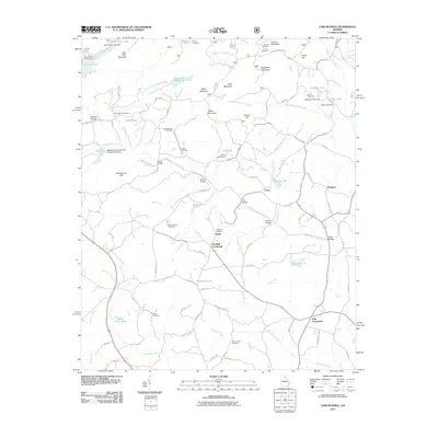
2011 Map of Lake Russell
USGS Topo · Published 2011About this map
Pruitt and Pinefield Crossroads center this landscape in northeastern Georgia, where the foothills meet the watershed of the Middle Fork Broad River. The terrain is characterized by a high density of small water management structures and family-named landmarks, including several ridges like Red Root Mountain and Soapstone Mountain. The area maintains a rural, dispersed settlement pattern, visible in the clustering of namesake cemeteries such as Broad River Cemetery, Leatherwood Cemetery, and Austin Cemetery. Modern recreation and local interests are represented by the Lake Russell Campground and the Banks County Speedway. Numerous small reservoirs, including Reservoir 17 and Reservoir 28, indicate a sophisticated system of local water control integrated into the various creek branches, such as Tates Creek and Brady Creek, which feed into the larger river system.
Find a feature on this map
100 named features on this map. Tap any name to fly to it.
Don’t see what you’re looking for? This feature index may not catch every label — zoom into the map to look around manually.
Map Details
Editions of this 2011 Lake Russell Map
This is the sole edition of this map. No revisions or reprints were ever made.
Other maps of this area

1886 · Dahlonega
USGS Topo · 1:125,000

1886 · Walhalla
USGS Topo · 1:125,000

1891 · Gainesville
USGS Topo · 1:125,000

1891 · Carnesville
USGS Topo · 1:125,000

1892 · Dahlonega
USGS Topo · 1:125,000

1892 · Walhalla
USGS Topo · 1:125,000

1896 · Walhalla
USGS Topo · 1:125,000

1896 · Dahlonega
USGS Topo · 1:125,000

1903 · Dahlonega
USGS Topo · 1:125,000

1954 · Greenville
USGS Topo · 1:250,000