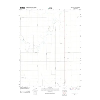
2012 Map of Lake Scott SW
USGS Topo · Published 2012About this map
Ladder Cr. meanders through this agricultural landscape in Scott County, creating the primary topographic variation in an otherwise highly organized grid of section lines and rural thoroughfares. The drainage pattern of the creek is flanked by private access points such as Omega Ranch Dr and Big Valley Dr, suggesting the long-standing ranching and farming operations that define the High Plains. Transport and local logistics are anchored by the Buehler Airport in the southwestern portion of the map, serving as a hub for aerial application and regional travel. The landscape is meticulously partitioned by a series of numbered roads, including W Road 240 and W Road 170, which facilitate the movement of goods and machinery across this expansive stretch of western Kansas.
Find a feature on this map
20 named features on this map. Tap any name to fly to it.
Don’t see what you’re looking for? This feature index may not catch every label — zoom into the map to look around manually.
Map Details
Editions of this 2012 Lake Scott SW Map
This is the sole edition of this map. No revisions or reprints were ever made.
Other maps of this area

1939 · Lake Mc Bride
USGS Topo · 1:24,000

1939 · Sandon
USGS Topo · 1:62,500

1939 · Pence
USGS Topo · 1:62,500

1940 · Scott City
USGS Topo · 1:62,500

1941 · Modoc
USGS Topo · 1:62,500

1941 · Pence
USGS Topo · 1:62,500

1942 · Sandon
USGS Topo · 1:62,500

1942 · Lake Mc Bride
USGS Topo · 1:31,680

1951 · Scott City
USGS Topo · 1:62,500

1951 · Modoc
USGS Topo · 1:62,500