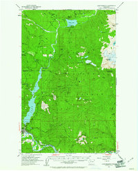
1952 Map of Lake Shannon
USGS Topo · Published 1961About this map
Industrial power and wilderness preservation intersect along the Baker River in the early 1950s. The town of Concrete serves as the focal point for regional infrastructure, anchored by the Baker Dam Powerhouse and a nearby rock quarry. The landscape is defined by the managed waters of Lake Shannon and the smaller Baker Lake, which are surrounded by the protective reaches of the Mount Baker National Forest. Isolated outposts like Morovitz Ranch and the Komo Kulshan Guard Station emphasize the remote character of this mountain territory.
Find a feature on this map
66 named features on this map. Tap any name to fly to it.
Don’t see what you’re looking for? This feature index may not catch every label — zoom into the map to look around manually.
Map Details
Editions of this 1952 Lake Shannon Map
Other maps of this area

1899 · Glacier Peak
USGS Topo · 1:125,000

1899 · Stillaguamish
USGS Topo · 1:125,000

1901 · Glacier Peak
USGS Topo · 1:125,000

1901 · Stilaguamish
USGS Topo · 1:125,000

1909 · Mt Baker
USGS Topo · 1:192,000

1915 · Mt. Baker
USGS Topo · 1:250,000

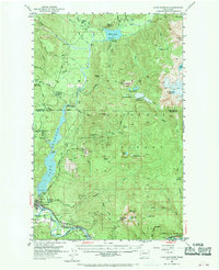
1952 · Lake Shannon
USGS Topo · 1:62,500

1952 · Mt. Baker
USGS Topo · 1:62,500

1952 · Hamilton
USGS Topo · 1:62,500

1953 · Mt Shuksan
USGS Topo · 1:62,500