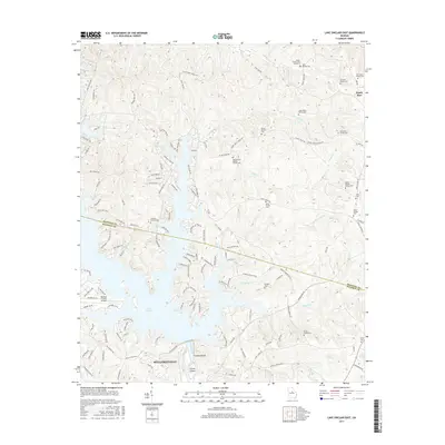
2017 Map of Lake Sinclair East
USGS Topo · Published 2017About this map
The Oconee River and the sprawling fingers of Lake Sinclair dominate this central Georgia landscape, where the boundary between Hancock and Baldwin counties follows the old river channel. Near Milledgeville, the map reveals a countryside characterized by numerous small family burial grounds, including the Harper Family Cem Number 2, Binion Family Cem, and the Quinn-Arnold Family Cem. These sites, often located near local drainages like Little Island Creek and Island Creek, provide essential anchors for genealogical research in the region.
Find a feature on this map
134 named features on this map. Tap any name to fly to it.
Don’t see what you’re looking for? This feature index may not catch every label — zoom into the map to look around manually.
Map Details
Editions of this 2017 Lake Sinclair East Map
This is the sole edition of this map. No revisions or reprints were ever made.
Other maps of this area

1912 · Milledgeville
USGS Topo · 1:62,500

1953 · Athens
USGS Topo · 1:250,000

1958 · Athens
USGS Topo · 1:250,000

1959 · Athens
USGS Topo · 1:250,000

1963 · Athens
USGS Topo · 1:250,000

1972 · Shoulderbone
USGS Topo · 1:24,000

1972 · Meda
USGS Topo · 1:24,000
1972 · Devereux
USGS Topo · 1:24,000
1972 · Browns Crossing
USGS Topo · 1:24,000
1972 · Lake Sinclair West
USGS Topo · 1:24,000