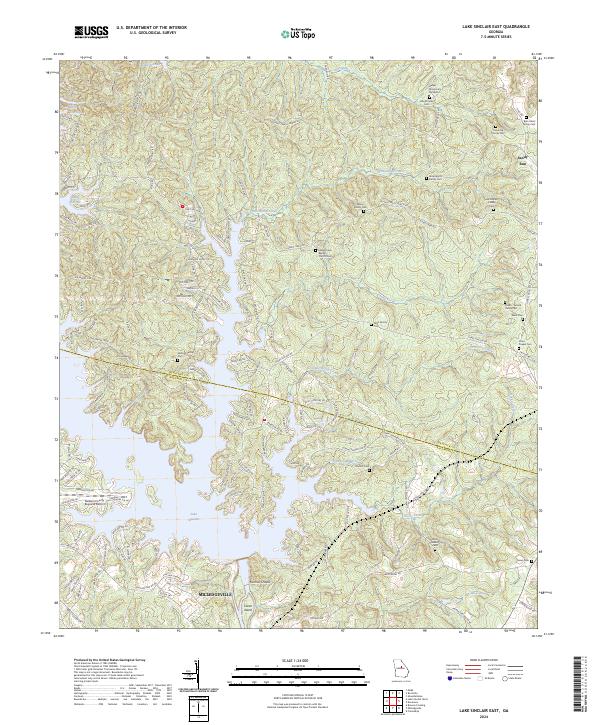
2024 Map of Lake Sinclair East
USGS Topo · Published 2024About this map
Lake Sinclair dominates the landscape of this region where the Hancock and Baldwin county lines meet. The reservoir's winding branches, including Island Creek and Little Rocky Creek, carve through the terrain, creating a complex network of points and coves. The southern edge of the map shows the northern reaches of Milledgeville, while the Baldwin County Regional Airport serves as a modern logistical hub nearby.
Find a feature on this map
137 named features on this map. Tap any name to fly to it.
Don’t see what you’re looking for? This feature index may not catch every label — zoom into the map to look around manually.
Map Details
Editions of this 2024 Lake Sinclair East Map
This is the sole edition of this map. No revisions or reprints were ever made.
Other maps of this area

1912 · Milledgeville
USGS Topo · 1:62,500

1953 · Athens
USGS Topo · 1:250,000

1958 · Athens
USGS Topo · 1:250,000

1959 · Athens
USGS Topo · 1:250,000

1963 · Athens
USGS Topo · 1:250,000

1972 · Shoulderbone
USGS Topo · 1:24,000

1972 · Meda
USGS Topo · 1:24,000
1972 · Devereux
USGS Topo · 1:24,000
1972 · Browns Crossing
USGS Topo · 1:24,000
1972 · Lake Sinclair West
USGS Topo · 1:24,000