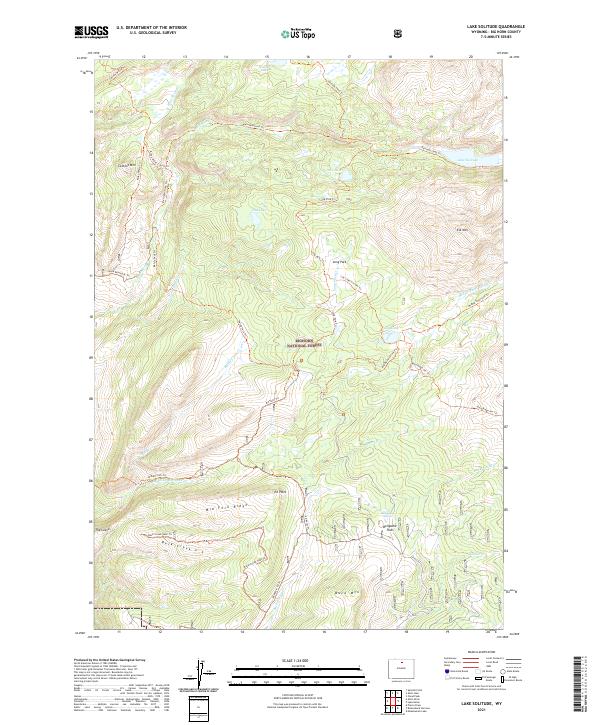
2021 Map of Lake Solitude
USGS Topo · Published 2021About this map
Bighorn National Forest defines this high-elevation landscape in Big Horn County, characterized by a complex network of glacial lakes and mountain peaks. Centered around Lake Solitude, the area serves as a primary drainage basin for Paint Rock Cr and its various branches, including N Paint Rock Cr and Middle Paint Rock Cr. The topographical relief is marked by prominent summits such as Cement Mtn, Elk Mtn, and Buck Mtn.
Find a feature on this map
44 named features on this map. Tap any name to fly to it.
Don’t see what you’re looking for? This feature index may not catch every label — zoom into the map to look around manually.
Map Details
Editions of this 2021 Lake Solitude Map
This is the sole edition of this map. No revisions or reprints were ever made.
Other maps of this area

1899 · Cloud peak
USGS Topo · 1:125,000

1901 · Cloud Peak
USGS Topo · 1:125,000

1955 · Sheridan
USGS Topo · 1:250,000

1958 · Sheridan
USGS Topo · 1:250,000

1960 · Shell Lake
USGS Topo · 1:24,000

1960 · Lake Solitude
USGS Topo · 1:24,000

1960 · Spanish Point
USGS Topo · 1:24,000

1962 · Sheridan
USGS Topo · 1:250,000

1967 · Brokenback Narrows
USGS Topo · 1:24,000
1967 · Meadowlark Lake
USGS Topo · 1:24,000