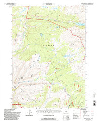
1993 Map of Lake Solitude
USGS Topo · Published 1997About this map
Bighorn National Forest serves as the backdrop for this high-altitude landscape, where the Cloud Peak Wilderness transition defines the northern reach. The map highlights a network of remote alpine waters, most notably the namesake Lake Solitude and the nearby Grace Lake, situated beneath the eastern slopes of Elk Mountain. The presence of Hyatt Cow Camp and Buck Creek Cow Camp indicates a persistent legacy of high-country grazing and seasonal ranching operations that characterize the region's land use.
Find a feature on this map
38 named features on this map. Tap any name to fly to it.
Don’t see what you’re looking for? This feature index may not catch every label — zoom into the map to look around manually.
Map Details
Editions of this 1993 Lake Solitude Map
This is the sole edition of this map. No revisions or reprints were ever made.
Other maps of this area

1899 · Cloud peak
USGS Topo · 1:125,000

1901 · Cloud Peak
USGS Topo · 1:125,000

1955 · Sheridan
USGS Topo · 1:250,000

1958 · Sheridan
USGS Topo · 1:250,000

1960 · Shell Lake
USGS Topo · 1:24,000

1960 · Lake Solitude
USGS Topo · 1:24,000

1960 · Spanish Point
USGS Topo · 1:24,000

1962 · Sheridan
USGS Topo · 1:250,000

1967 · Brokenback Narrows
USGS Topo · 1:24,000
1967 · Meadowlark Lake
USGS Topo · 1:24,000